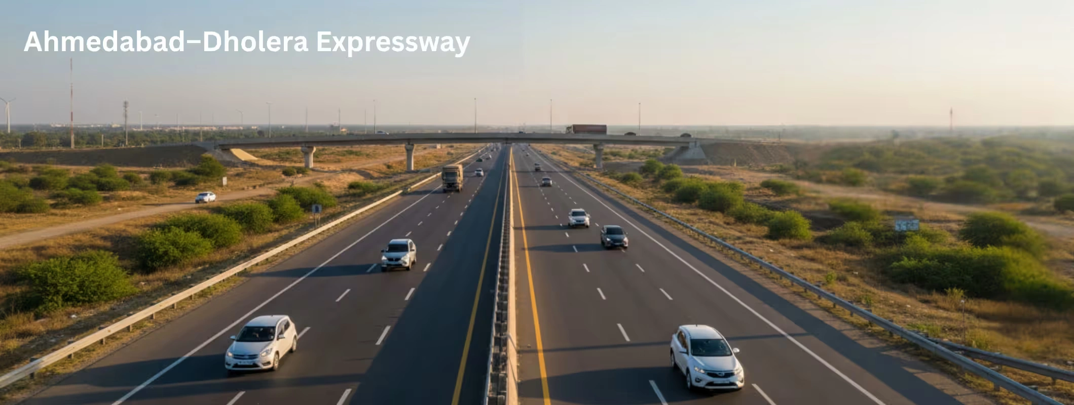
A 2+ hour road trip turning into a 45-minute drive doesn’t just make weekends easier. It changes how people choose homes, where companies place factories, and which “farmland” suddenly starts getting pitched as “future growth land.” That’s the real story behind the Ahmedabad–Dholera Expressway (NE-8), a 109.019 km access-controlled corridor built under the Bharatmala Pariyojana.
And yes, the “45 minutes” claim isn’t a random marketing line. A Government of India Press Information Bureau release says the corridor reduces travel between Ahmedabad and Dholera from about 100 km and 2 hours 15 minutes to roughly 83 km and 45 minutes.
Now let’s talk about what this actually means for real estate, agricultural land, and long-term investment logic, without the hype. Faster connectivity often reshapes regional development patterns. Areas that were previously considered distant farmland can suddenly fall within practical commuting or industrial zones. Because of this shift, interest from investors and developers tends to increase, especially in regions connected by new infrastructure corridors.
With the growth of the Dholera Special Investment Region, the expressway is expected to support industrial expansion, logistics hubs, and new residential developments. As a result, many investors and businesses are closely monitoring the corridor for long-term opportunities, particularly those looking to purchase land in Dholera as part of future development and investment strategies.
What makes this expressway different (and why greenfield matters)
This isn’t a widened old highway. It’s greenfield, which means the alignment is planned fresh. designed for higher average speeds, fewer local intersections, and cleaner access management.
According to PIB, the expressway:
- is 109.019 km long
- passes through Ahmedabad and Bhavnagar districts
- has been opened to the public for testing purposes
Back in 2023, PIB described it as a 109 km greenfield corridor being developed at a cost of ₹4,200 crore and highlighted its role in connecting Ahmedabad to Dholera and the airport.
Translation: cost and scope have evolved as execution progressed, normal for large infrastructure projects.
The headline impact: Ahmedabad ↔ Dholera in 45 minutes
Here’s the practical takeaway:
- People can realistically consider Dholera-side development as a “day trip” from Ahmedabad.
- Businesses can plan logistics, staff movement, and supply chains with a new time-and-distance math.
- Real estate starts reacting early—often even during trial runs—because markets price in future convenience fast.
PIB’s numbers say:
- Ahmedabad → Dholera: 2 hr 15 min → 45 min and 100 km → 83 km
- Ahmedabad → Bhavnagar: 3 hr 15 min → 1 hr 45 min and 169 km → 141 km
Key Features that matter to Property Buyers
Most buyers focus on “fast road = price rise.” That’s incomplete. The features decide where the value concentrates.
1) Airport connectivity is a direct real estate lever
PIB explicitly mentions direct connectivity to Dholera International Airport via an interchange (noted at Ch. 67). If you’re looking at land plays, airport-oriented infrastructure typically creates demand for:
- logistics and warehousing
- hospitality
- staff housing
- vendor ecosystems (packaging, maintenance, transport)
2) Future expansion planning affects long-term capacity
PIB notes a 30-metre-wide median designed for future expansion to 8 lanes. That matters because capacity constraints can kill “growth corridor” stories if the road chokes later.
3) It’s access-controlled, this is where many investors get it wrong
Access control keeps speeds high, but it also means:
- you can’t enter/exit anywhere you want
- “highway-touch” land isn’t automatically usable commercially
- interchanges become the real value magnets
So the smarter question is not “How close is my plot to the expressway?”
It’s: “How far is it from a legitimate interchange, and do I have legal approach road access?”
Why Dholera SIR is the real engine behind the expressway story
Dholera isn’t being positioned as just another town expansion. It’s being developed as a major industrial node.
- The Government of Gujarat’s Dholera portal states that the SPV Dholera Industrial City Development Limited (DICDL) is a joint venture between the Government of Gujarat (through DSIRDA) and the Government of India (through NICDIT under NICDC).
- NICDC calls DSIR the largest node under DMIC, spanning 920 sq. km, managed by DICDL, and says the 22.
- 54 sq. km Activation Area is “almost completed” with trunk infrastructure in place. The Indian Express has reported DSIR’s long-term scale and significance, including targets for jobs and population by 2040.
So when people say “Ahmedabad–Dholera Expressway = land boom,” the more accurate version is:
Ahmedabad–Dholera Expressway = the connectivity backbone for a planned industrial region.
And industrial ecosystems create sustained real estate demand if employment and liveability follow.
Real estate impact: what’s likely to move, and what’s pure noise
Let’s separate real opportunity from WhatsApp-forward speculation.
What Usually Benefits First
1) Logistics and industrial-adjacent zones
If DSIR continues attracting manufacturing and large investments, demand rises for:
- industrial land (where permitted)
- worker housing
- warehouses and cold chains
- vendor parks
2) Interchange-led micro-markets
Access-controlled roads reward nodes, not random stretches. Interchanges become hotbeds for:
- fuel stations, eateries (planned zones)
- truck services
- small commercial clusters
- budget hospitality
3) Ahmedabad outskirts with clean connectivity
People often underestimate this: better expressways also boost demand on the “city side” because companies expand where talent already lives. That can indirectly influence land for sale in Ahmedabad (especially peripheral parcels with clear zoning and road access), because businesses prefer predictable commute patterns.
What’s mostly noise (and risky)
1) “Road-touch farmland” pitches
Many sellers market agricultural land as “expressway-facing.” But access-controlled highways reduce direct roadside commercial upside. If you can’t legally access the land from an approved approach road, the “road-touch” story is useless.
2) Plots sold only on future conversion promises
If your ROI depends on CLU/NA conversion, treat it as uncertain unless you’ve verified:
- current land use
- conversion rules
- local development plan direction
- legal approach road
- and whether the area is restricted/affected by acquisition or buffers
Agricultural land angle: opportunity with real constraints
This corridor will definitely raise interest in agricultural land—especially for people thinking “buy now, hold, convert later.” Here’s the hard truth: agricultural land can be a smart hold, but it’s also where people get trapped.
Why agricultural land gets attention near corridors
- faster movement to markets
- potential for agro-logistics (packhouses, cold storage)
- more developer interest in land assembly
The constraints that decide whether it’s worth it
- Land-use conversion isn’t automatic.
- Access matters more than distance from the expressway.
- Documentation and title chain become non-negotiable.
- Some areas can face planning restrictions, environmental conditions, or acquisition risk.
If you’re considering agricultural land around this belt, your first goal isn’t “best price.”
Your first goal is clean legality + usable access + realistic exit options.
A quick “buyer sanity checklist” before you invest
If you’re buying land (agri or plotted) because of the expressway, do these checks:
- Confirm exact coordinates + village map records (not just a brochure map)
- Verify the approach road (public road access, not informal right-of-way)
- Check land-use zoning and whether conversion is allowed/likely
- Ask for encumbrance proof and ownership chain clarity
- Avoid deals marketed as “near interchange” unless the interchange is actually approved and accessible
- Stress-test your timeline: if real demand takes 3–5 years, can you hold without pressure?
This is how you avoid becoming exit liquidity for someone else’s speculation.
The sustainability angle (yes, it matters for long-term development)
PIB highlights an “environment-first” approach including:
- reuse of Ahmedabad Municipal Corporation waste in embankments
- use of fly ash
- and significant plantation numbers in the median and avenues
Whether you’re an investor or an end user, sustainability practices increasingly influence:
- regulatory approvals
- public perception
- and long-term infrastructure quality
Not the main reason to buy land, but it’s a positive signal for project seriousness.
Who benefits most from this expressway (realistically)
- End users: faster trips, more predictable travel, easier business movement.
- Industries tied to DSIR growth: vendor ecosystems, housing demand, logistics
- Long-horizon land investors who buy legally clean parcels near logical nodes (not random “near the road” land)
Who should be careful?
Short-term flippers expect instant appreciation, especially in agricultural land with weak documentation.
FAQ - Ahmedabad–Dholera Expressway
1. Is the Ahmedabad–Dholera Expressway open right now?
PIB says it has been opened to the public for testing purposes, while final operational readiness is assessed.
2. Is the travel time really 45 minutes?
PIB reports Ahmedabad to Dholera reduces to 83 km and 45 minutes from 100 km and 2 hr 15 min.
3. Why is this expressway so important for real estate?
Because it’s the connectivity spine for Dholera SIR, a major DMIC node with large-scale planned development.
4. Should I buy agricultural land near the expressway?
Only if you can verify land title, legal access, zoning direction, and a realistic exit plan. “Near expressway” alone is not a strategy.