Key Takeaways
- A Shajra map is a village or cadastral land map that helps identify the location, boundaries and relative position of individual plots or Gata/Khasra numbers.
- In Uttar Pradesh, the official BhuNaksha UP portal allows users to view digital land maps by selecting the district, tehsil and village.
- The Uttar Pradesh Board of Revenue identifies Bhu-Naksha/Shajra as an official land-record service and provides options to view the revenue-village map and Gata boundaries.
- A Shajra map should be checked alongside Khatauni, Khasra, mutation records and registered documents. The map alone does not establish clear ownership.
- Buyers searching for agricultural land for sale in Uttar Pradesh should use the map to cross-check the physical location and boundaries before arranging a site visit or paying a token amount.
- The official UP Bhulekh system also provides access to land-record information, including Gata-related sale status, litigation status and other linked records.
- Online maps are excellent for preliminary verification, but a transaction should still involve appropriate legal and revenue-record checks.
What is a Shajra Map in Uttar Pradesh?
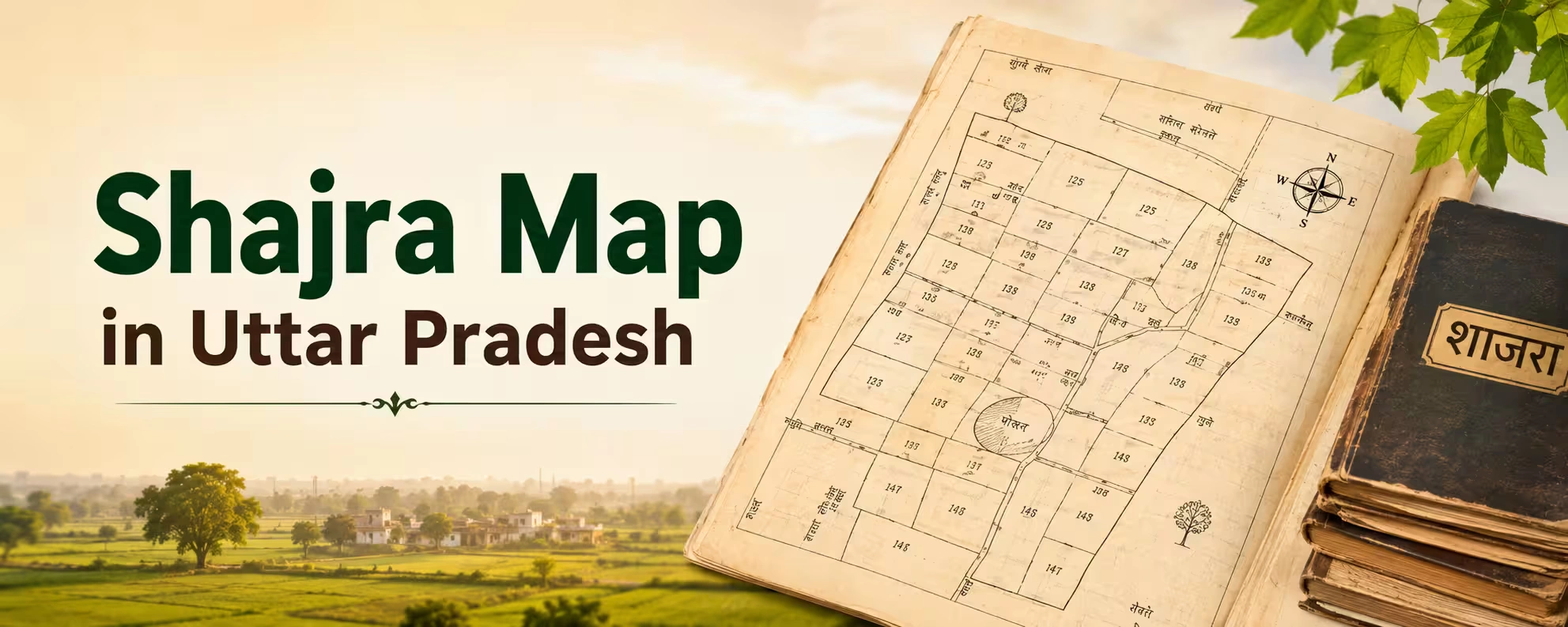
A Shajra map is a traditional revenue or cadastral map used to represent the layout of land parcels within a village or revenue area.
In practical terms, think of it as a map of the land records.
While a Khatauni generally helps you understand rights and landholding information, and a Khasra provides field-level details, the Shajra or BhuNaksha helps you understand where the parcel sits on the ground in relation to surrounding plots, roads and other mapped features.
This becomes particularly useful when someone gives you a Gata or Khasra number and says: "This is the land."
Instead of relying entirely on the seller's explanation, you can use the official digital map to locate the corresponding parcel and examine its mapped position.
The Uttar Pradesh Board of Revenue specifically lists Bhu-Naksha / Shajra as a land-record service and states that users can view the revenue-village map and the boundaries of a Gata.
The state also operates a dedicated BhuNaksha portal for digital cadastral maps.
Why is a Shajra Map Important When Buying Land?
Land transactions often become complicated because buyers focus heavily on the sale deed and price while overlooking the physical identity of the parcel.
Imagine a buyer is shown a field in a village and told that it is Gata No. 245.
The buyer may like the road frontage, negotiate the price and proceed with the transaction.
But what if the land being shown is actually a neighbouring parcel?
That is where a map becomes useful.
A Shajra map can help you cross-check:
- Gata/Khasra number
- Relative location of the parcel
- Shape of the plot
- Adjacent parcels
- Mapped roads
- Village layout
- Boundaries
- Relationship with nearby Gata numbers
It is especially valuable when buying large agricultural parcels, land in rural areas or property where physical boundaries are not clearly marked.
However, there is an important distinction:
A map helps identify the parcel. It does not by itself prove that the seller owns the parcel free from disputes or encumbrances.
Ownership and transaction history should be checked through the appropriate land and registration records.
Shajra Map vs Khatauni vs Khasra: What's the Difference?
These terms are often used together, which can confuse first-time land buyers.
Record | What It Generally Helps You Understand |
Shajra / BhuNaksha | Location, shape, boundaries and relative position of land parcels |
Khasra | Field/plot-level land and cultivation-related record |
Khatauni | Record of rights/landholding information |
Sale Deed | Registered transaction document showing the transfer described in the deed |
Mutation | Revenue-record update following a transfer or succession |
Encumbrance-related records | Helps investigate registered charges/interests and transaction history |
The Uttar Pradesh government describes Bhulekh as a portal through which citizens can access land-related information and linked Gata records, including map, mutation, sale and litigation status.
The best approach is therefore not: "I checked the Shajra, so the land is safe."
It is:
Shajra + Khasra + Khatauni + registered documents + mutation + physical verification.
That combination gives a much stronger picture.
Official Uttar Pradesh Shajra Map Portal
For digital cadastral maps, Uttar Pradesh provides the official BhuNaksha portal.
The portal currently provides fields for location selection and plot identification, including district, tehsil, village and plot number. It also offers map layers such as a base map and satellite layer.
The broader Uttar Pradesh Revenue Department also links Bhu-Naksha/Shajra as an official land-record service.
For land-record information, use the official UP Bhulekh portal:
The portal provides access to Khatauni information and related Gata-level services.
Tip: Save the official URLs rather than relying on third-party websites that use similar names.
How to Check Shajra Map in Uttar Pradesh Online
Checking a land map online is relatively straightforward once you have the correct location details.
You will generally need information such as:
- District
- Tehsil
- Village
- Gata/Khasra or plot number
The most important piece is usually the correct revenue village.
A seller may tell you the name of a nearby town or locality, but the BhuNaksha system works around revenue-administration details. Therefore, ask the seller for the exact village and Gata/Khasra number.
Step 1: Open the Official BhuNaksha Website
Visit the official Uttar Pradesh BhuNaksha portal.
The official portal displays location fields and a plot-number search interface.
Step 2: Select the District
Choose the district where the property is located.
For example, if you are researching agricultural property around Lucknow, Meerut, Noida, Agra, Kanpur, Varanasi or another district, select the appropriate district from the available options.
Do not select a nearby district simply because the property is marketed using a famous city name.
This is a common issue in property listings.
A seller may advertise land as being "near Noida" even though the revenue village is technically outside the city.
For legal and revenue-record verification, always work with the actual village and land record details.
Step 3: Select the Tehsil
After selecting the district, choose the relevant tehsil.
The tehsil matters because the same village name can sometimes exist in different administrative areas.
If you are unsure, compare the details with:
- Existing Khatauni
- Khasra
- Sale deed
- Seller's land records
- Revenue-office information
Don't guess.
Step 4: Select the Village
Select the correct revenue village.
This is one of the most important steps.
If the seller gives you only a nearby town, highway or landmark, ask for the official revenue-village name before proceeding.
Once the correct location is selected, the map interface can display the corresponding cadastral map. The official BhuNaksha interface provides district, tehsil and village selection before showing the map.
Step 5: Find the Gata or Plot Number
Now identify the Gata/Khasra number of the property.
You may be able to enter the plot number into the available search field or select the parcel directly on the map.
For example:
Gata No. 125/2
or
Khasra No. 318
The exact numbering format can vary.
If the seller gives you a number that does not appear on the map, don't immediately assume that the website is wrong.
Possible reasons include:
- Incorrect number
- Different village selected
- Sub-divided Gata
- Old versus updated record
- Typing error
- Map or record linkage issue
- Land record requiring local verification
Resolve the discrepancy before moving ahead.
Step 6: Check the Plot on the Map
Once you identify the parcel, examine its position carefully.
Don't just confirm that the number exists.
Look at:
- Shape
- Adjacent plots
- Roads
- Nearby parcels
- Access route
- Location relative to the village
- Whether the mapped shape resembles the land shown to you
This is where the Shajra becomes genuinely useful.
Suppose the seller shows you a rectangular field.
The digital map shows a narrow triangular parcel.
That discrepancy deserves investigation.
Likewise, if the seller says the property has direct road frontage but the map does not appear to show the claimed access, ask questions before paying anything.
Step 7: Use the Map Report or Available Print/Download Option
The BhuNaksha system is designed to provide digital cadastral-map information, and the portal includes map-related functionality.
Depending on the current interface and the selected location, the available map/report options may allow you to print or save the map information.
Because government portals can change their interface over time, the exact button placement may differ.
If you need a document for an official transaction, do not assume that a browser screenshot is equivalent to a certified government copy.
For formal use, ask the relevant revenue authority or professional adviser which version of the map or record is required.
Can You Download a Shajra Map Online?
In many cases, the digital BhuNaksha system provides map/report functionality that allows users to obtain or print the displayed cadastral map. The official Uttar Pradesh BhuNaksha platform is specifically designed for accessing digital cadastral maps.
However, there is an important difference between: Viewing a digital map online and Obtaining a certified copy for an official/legal purpose.
If you are simply researching a property, a digital map or printout can be very useful.
If you are preparing for registration, a dispute, a court matter or another formal process, confirm the required document with the concerned authority.
The Uttar Pradesh Revenue Department separately provides certified-copy services for certain land records, while its public service listings identify Bhu-Naksha/Shajra as the map service.
What Information Can You Learn From a Shajra Map?
A Shajra map is most useful for understanding spatial information.
Depending on the available map and location, you may be able to identify:
1. Plot Location
You can see where the parcel sits within the village or mapped revenue area.
2. Plot Boundaries
The map helps show the mapped limits of individual parcels.
3. Neighbouring Gata Numbers
Adjacent plots can help you compare the map with the seller's physical description.
4. Road Position
Mapped roads can help you investigate whether the property appears to have the claimed access.
5. Parcel Shape
The shape can be particularly useful when comparing the online record with a physical site.
6. Spatial Relationship
You can understand whether the property sits close to a village settlement, road or neighbouring parcel.
The official Revenue Department specifically describes the Shajra/Bhu-Naksha service as providing the revenue-village map and Gata boundaries.
How to Match a Shajra Map With the Physical Land
This is one of the most useful steps for an actual buyer.
Let's say you are considering agricultural land for sale in Uttar Pradesh.
The seller gives you:
- Village name
- Gata number
- Area
- Location pin
- Asking price
Before visiting, check the BhuNaksha.
Then, during the site visit, compare:
Map → Road → Adjacent plots → Boundary markers → Physical parcel
Look for identifiable features.
For example:
- Is there a road on the same side?
- Does the neighbouring parcel match?
- Is the field shape similar?
- Are there visible boundary markers?
- Does the area appear consistent?
- Is the access route the same as the seller described?
If several elements don't match, pause the transaction.
This is not about assuming the seller is dishonest. Rural land records and physical boundaries can be complicated, and discrepancies need to be resolved professionally.
Shajra Map and Agricultural Land Purchases
The map becomes especially important when buying farmland because agricultural parcels can be large and boundaries may be less obvious than in an urban plotted development.
If you are searching for farm land for sale in Uttar Pradesh, don't evaluate the property only by price per bigha or acre.
Also verify:
- Gata/Khasra number
- Land area
- Land category
- Ownership
- Irrigation
- Access
- Adjacent parcels
- Revenue records
- Existing structures
- Applicable land-use restrictions
A beautiful farm surrounded by open fields may look perfect during a site visit.
But if the parcel shown to you cannot be correctly matched to the revenue map and records, the purchase should not move forward until the discrepancy is resolved.
Shajra Map for Land Sellers
The map is useful for sellers too.
If you want to sell land in Uttar Pradesh, providing accurate property information can make your listing more credible.
A good online listing should ideally include:
- Correct village
- Gata/Khasra number
- Land area
- Location
- Road access
- Property photographs
- Asking price
- Land type
- Available documentation
A seller who clearly identifies the property makes it easier for serious buyers to conduct preliminary research.
This is increasingly relevant because buyers now discover land through digital platforms before contacting local brokers.
Using Real Estate Websites to Research Land
Modern buyers often begin with real estate websites rather than visiting a broker's office.
That makes property discovery faster, but online listings still need verification.
You can use online platforms to:
- Compare asking prices
- Identify localities
- Understand parcel sizes
- Find potential sellers
- Shortlist properties
- Study surrounding development
- Compare multiple options
For agricultural land, however, the workflow should be:
Property listing → Gata/Khasra details → BhuNaksha → Bhulekh → Physical visit → Legal verification
Do not reverse that process.
The listing is marketing information.
The government records are part of your verification process.
Property Listing Websites vs Government Land Records
This distinction is critical.
Source | Primary Purpose | How a Buyer Should Use It |
Property listing website | Property discovery and marketing | Find and compare options |
2Bigha | Land-focused property discovery | Search and shortlist agricultural/farm land |
UP Bhulekh | Revenue/land-record information | Check land-related records |
UP BhuNaksha | Cadastral mapping | Check mapped location and parcel boundaries |
IGRSUP | Registration-related services | Check registered-document and property-registration services |
Physical site visit | Reality check | Confirm actual condition and access |
The Uttar Pradesh Stamp and Registration Department currently lists services including property search, registered-document copies, encumbrance-related certificates and rural land/property maps.
This illustrates why no single website should be treated as the complete property-verification system.
How 2Bigha Can Help With Land Discovery
2Bigha is a land-focused digital platform designed to make agricultural and land-property discovery easier.
If you are searching for farmland, you can use the platform at the discovery and comparison stage to explore available land listings and identify properties that match your location, size and budget requirements.
The useful workflow is:
Discover on 2Bigha → Collect Gata/Khasra details → Check official records → Visit the site → Verify documents → Make a decision
This approach combines the convenience of online search with the caution required for land transactions.
For sellers, a digital platform can also make the property visible to buyers who may be searching beyond their immediate local broker network.
2Bigha also offers a subscription plan and property management service for users who need additional ongoing support.
The key principle remains the same:
Use technology to discover and organise information; use official records and professional verification to establish the facts.
How Shajra, Bhulekh and Registration Records Work Together
A smart land buyer should think of these records as different pieces of the same puzzle.
Shajra / BhuNaksha
Answers:
"Where is the parcel and what does its mapped boundary look like?"
Khasra
Helps answer:
"What field/plot is being referred to in the revenue record?"
Khatauni
Helps answer:
"Who is recorded with rights/holding information?"
Registered Sale Deed
Helps answer:
"What transaction has been registered and what property does the document describe?"
Mutation
Helps answer:
"Has the revenue record been updated following a relevant transfer or succession?"
Registration-related searches/certificates
Can help investigate registered documents and other transaction-related information.
The Uttar Pradesh Bhulekh portal specifically provides access to Gata-related sale status, litigation status, map information and mutation-related information.
The IGRSUP system also provides services for certified copies of registered documents and encumbrance-related certificates.
What to Do If the Shajra Map and Land Records Don't Match
This situation deserves immediate attention.
Suppose:
- Sale deed says Gata 512
- Khatauni refers to Gata 512
- BhuNaksha shows a different shape
- Seller points you to another field
Don't try to "figure it out later."
Stop and investigate.
Possible reasons can include:
- Record updates
- Subdivision
- Consolidation
- Old survey references
- Mapping issues
- Typographical errors
- Incorrect property identification
- Boundary disputes
The Uttar Pradesh Revenue Code includes provisions relating to revision of maps and records, including survey, map correction, field-to-field verification and testing of current records.
This is one reason experienced buyers do not rely on one document.
When records conflict, consult the appropriate revenue authority and a qualified property lawyer or land-record professional before proceeding.
Can a Shajra Map Prove Ownership?
No.
This is one of the most important points to remember.
A map primarily helps establish the mapped identity and spatial position of a parcel.
It should not be treated as a standalone ownership certificate.
Ownership-related verification should involve the appropriate revenue records and registered documents.
The UP Bhulekh portal itself separates services for Khatauni, sale status, litigation status and map-related information, reinforcing the fact that land verification involves multiple records rather than one document.
If someone says: "The name is visible on the map, so you don't need anything else."
Treat that statement cautiously.
A property purchase should be based on a complete record review.
Shajra Map Download Checklist
Before saving or printing a map for your property file, check:
- Correct district selected
- Correct tehsil selected
- Correct revenue village selected
- Correct Gata/Khasra number identified
- Parcel shape checked
- Adjacent plots compared
- Road/access position reviewed
- Map details compared with Khatauni
- Map details compared with Khasra
- Physical property visited
- Boundaries checked on site
- Any discrepancy documented
- Certified records obtained where required
Keep the map along with the other property documents rather than storing it separately.
Common Mistakes Buyers Make While Checking Shajra
Mistake 1: Using the Wrong Village
A nearby town name is not necessarily the revenue-village name.
Mistake 2: Checking Only the Plot Number
A number alone is not enough. Check its position and surrounding parcels.
Mistake 3: Assuming the Map Proves Ownership
It doesn't.
Mistake 4: Ignoring Road Access
A parcel can appear close to a road on a broad map without having the legal or physical access the seller claims.
Mistake 5: Skipping the Site Visit
Digital maps cannot show every physical reality.
Mistake 6: Treating a Screenshot as a Certified Document
A screenshot can help with preliminary research but should not automatically be treated as a certified record.
Mistake 7: Trusting Only a Property Listing
Even the best property listing websites are primarily discovery tools. Buyers still need independent verification.
How to Use a Shajra Map Before Buying Land: A Practical Example
Imagine you find a property advertised as:
"10 Bigha agricultural land near Lucknow, road-facing, clear title."
Before visiting, ask the seller for:
- Revenue village
- Gata/Khasra number
- Khata number
- Total recorded area
- Copy of available land records
Then:
Step 1: Search the village on BhuNaksha.
Step 2: Locate the Gata number.
Step 3: Compare the parcel shape.
Step 4: Examine adjacent Gata numbers.
Step 5: Check the claimed road frontage.
Step 6: Compare the land area with the revenue record.
Step 7: Check the corresponding land records on Bhulekh.
Step 8: Visit the property.
Step 9: Match physical boundaries with the map.
Step 10: Have the relevant documents professionally reviewed before making a substantial payment.
This process may take longer than simply visiting the property.
It can also save you from wasting time on the wrong property.
What Buyers Searching for Agricultural Land in Uttar Pradesh Should Remember
The phrase agricultural land for sale in Uttar Pradesh covers an enormous and diverse market.
A parcel near an expanding urban area is different from farmland deep inside a rural belt.
Likewise, farm land for sale in Uttar Pradesh can mean anything from productive agricultural acreage to land being marketed primarily as a future investment.
That is why the Shajra map is valuable.
It forces the buyer to move from a vague description such as:
"Land is near the highway."
to a more precise question:
"Which Gata is it, where is that Gata on the revenue map, and does the physical parcel match?"
That is a much better starting point for a serious transaction.
For Sellers: Why Accurate Land Information Matters
If your goal is to sell land in Uttar Pradesh, accuracy can become a competitive advantage.
A buyer who receives the correct:
- Gata number
- Village name
- Land area
- Location
- Map reference
- Available records
can conduct preliminary research before contacting you.
That helps filter out casual enquiries and attracts buyers with genuine intent.
If you list your property online, avoid exaggerated statements such as:
- "Guaranteed appreciation"
- "Future commercial land"
- "Government project coming soon"
- "Residential conversion guaranteed"
unless the relevant claim can be independently substantiated.
Experienced buyers increasingly look for documentation, not just sales language.
Final Verdict: Is Checking the Shajra Map Necessary?
If you are seriously considering land in Uttar Pradesh, checking the Shajra/BhuNaksha is a very useful part of preliminary due diligence.
It helps answer a basic but essential question:
"Is the land being shown to me the same parcel described in the records?"
But it should never be the only check.
A safer land-buying process is:
Find the property → Get Gata/Khasra details → Check Shajra/BhuNaksha → Check Bhulekh → Review registered documents → Visit the site → Resolve discrepancies → Take professional advice → Proceed with the transaction.
For buyers exploring agricultural land for sale in Uttar Pradesh, this process can significantly improve the quality of the shortlist.
For sellers, accurate land information can make online property discovery more transparent.
And for anyone using real estate websites or a dedicated land marketplace such as 2Bigha, the most important mindset is simple:
Online discovery can tell you what is being offered. Official records and professional verification help you understand what you are actually buying.
Disclaimer: This article is for informational purposes only and should not be considered investment, legal, financial, or property advice. Real estate regulations, infrastructure plans, market conditions, and government policies may change over time. Readers are advised to verify information with relevant authorities and consult qualified professionals before making any investment or property-related decisions.