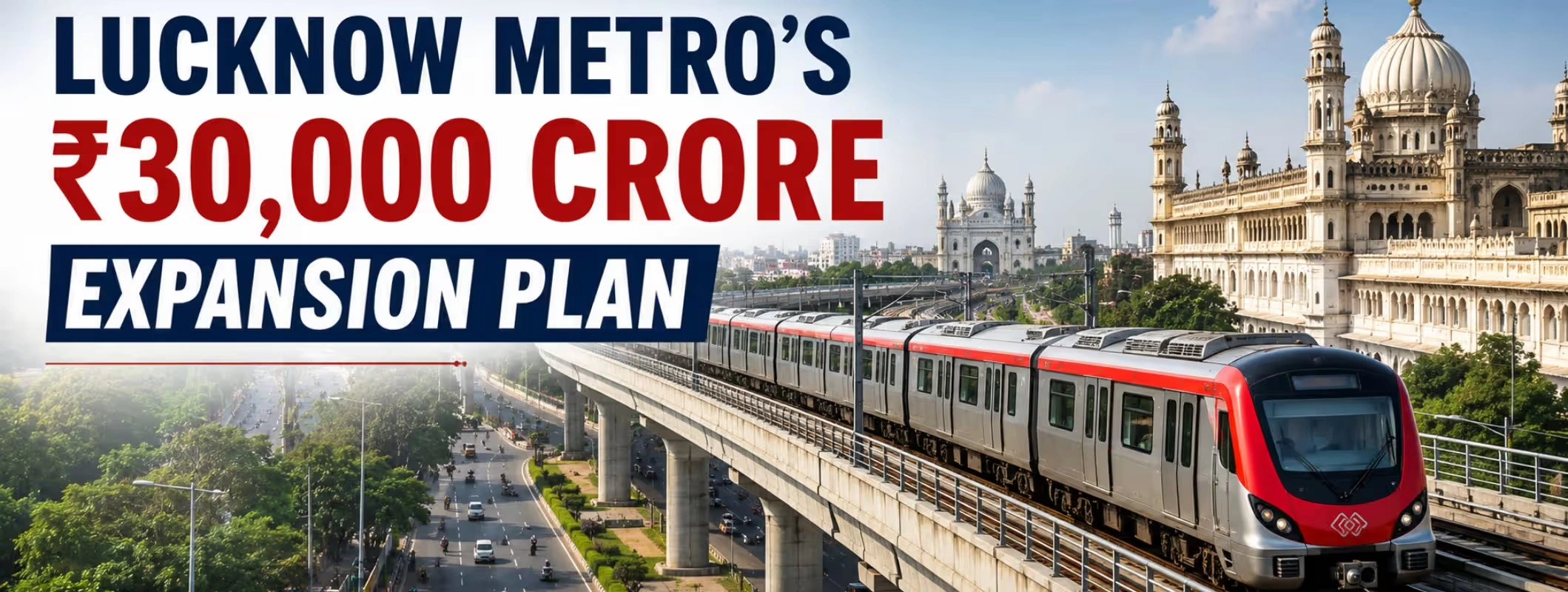
Lucknow may be preparing for one of the biggest urban transport transformations in northern India. A reported long-term blueprint proposes expanding the city’s metro network to approximately 150–170 kilometres, with possible connections extending beyond Lucknow towards Barabanki and other surrounding growth areas.
The estimated investment associated with this wider vision is around ₹30,000 crore. However, buyers, commuters and property investors need to understand one important fact: the entire plan has not received final construction approval. The proposed expansion is also drawing attention from rural land buyers in Lucknow who are closely tracking future infrastructure-led growth opportunities on the city’s outskirts.
The approved Charbagh–Vasant Kunj East–West Corridor and the broader Lucknow Metro expansion are at different stages. The East–West line has secured government approval, while several other routes—including the Barabanki connection—remain under consideration, survey, planning or Detailed Project Report stages.
Key Takeaways
- The proposed metro blueprint could expand Lucknow’s network to roughly 150–170 kilometres through multiple corridors.
- The estimated investment for the wider expansion vision is approximately ₹30,000 crore, but this is not the final sanctioned cost of one approved project.
- The approved Phase 1B corridor will connect Charbagh with Vasant Kunj through Old Lucknow.
- The Barabanki connection is expected to move through the Ayodhya Road side, potentially covering Polytechnic, Kamta, Matiyari and Anaura Kala before entering Barabanki.
- No final station list, operational date or complete official route map has been announced for the Barabanki section.
- Areas such as Kamta, Matiyari, Anaura Kala, Safedabad and the Lucknow–Barabanki belt could receive more real estate attention if the route receives approval.
- Property buyers should not purchase land solely on the basis of an advertised “upcoming metro station”.
- Legal title, land use, road access, drainage, project approval and actual distance from the proposed alignment remain more important than speculative claims.
What Is the ₹30,000 Crore Lucknow Metro Expansion Plan?
The Lucknow Metro expansion plan 2026 refers to a reported long-term urban mobility blueprint under which Lucknow’s present metro system could grow into a wider regional network.
The vision reportedly includes around 150 kilometres of elevated lines and approximately 20 kilometres of underground sections. The proposed system may eventually connect established neighbourhoods, outer residential belts, employment centres, hospitals, educational institutions and neighbouring districts.
The plan is significant because Lucknow is no longer growing only within its traditional municipal core. Development has moved rapidly towards Ayodhya Road, Shaheed Path, Sultanpur Road, Rae Bareli Road, IIM Road, Sitapur Road, Deva Road and the Outer Ring Road.
A metro grid connecting these directions could reduce dependence on private vehicles and create a more integrated metropolitan region. It may also help distribute housing and commercial demand across several corridors instead of concentrating development in a few central neighbourhoods.
However, the reported blueprint should not be confused with a construction-ready programme. Detailed Project Reports, passenger-demand studies, route alignments, environmental assessments, land requirements, funding arrangements and multiple government approvals will determine which routes move forward.
Current Status of Lucknow Metro Projects
| Metro component | Approximate length | Reported status | Important clarification |
| Existing North–South Corridor | 22.878 km | Operational | Connects CCS Airport with Munshipulia |
| Charbagh–Vasant Kunj East–West Corridor | 11.165 km | Approved | Includes 12 stations and an approved outlay of ₹5,801 crore |
| Wider metro blueprint | 150–170 km | Long-term proposal | Estimated at around ₹30,000 crore; individual corridors require separate approvals |
| Anaura Kala–Barabanki section | Around 14.43 km | Proposed | Alignment and station details are not final |
| Indira Nagar–Anaura Kala connection | Length not officially finalised publicly | Proposed | Intended to serve the Ayodhya Road growth belt |
This distinction matters. The Lucknow Metro ₹30,000 crore project is not one fully approved corridor with a fixed opening date. It represents a broader network vision consisting of several possible routes.
Is There a Direct Charbagh to Barabanki Metro Route?
Not yet.
The phrase Charbagh to Barabanki Metro describes the larger connectivity vision rather than a formally approved, single end-to-end corridor with final stations.
Charbagh is expected to become a major interchange because the operational North–South line already passes through it, while the approved East–West Corridor will also connect there. The Barabanki side is reportedly being considered through an eastward extension connecting Indira Nagar, Polytechnic, Kamta, Matiyari and Anaura Kala before reaching Barabanki.
For buyers and investors exploring rural land near Barabanki and emerging growth areas along the proposed alignment, the planned metro expansion is being closely watched for its potential impact on connectivity and future development.
A passenger travelling from Charbagh to Barabanki in a future completed network may therefore need to interchange rather than use one uninterrupted line. The final arrangement will depend on the approved DPR and network design.
Any online Charbagh to Barabanki Metro route map should currently be treated as indicative unless it comes from UPMRC or another competent government authority after the DPR is approved.
What Has Already Been Approved?
The clearest approved expansion is Phase 1B, the East–West Corridor from Charbagh to Vasant Kunj.
The Union Cabinet approved this 11.165-kilometre corridor with an outlay of ₹5,801 crore. It will include 12 stations—seven underground and five elevated—and connect several heavily populated and historically important parts of Old Lucknow.
The underground stations identified for this corridor include:
- Charbagh
- Gautam Buddha Marg
- Aminabad
- Pandeyganj
- City Railway Station
- Medical Crossing
- Chowk
The elevated section includes:
- Thakurganj
- Balaganj
- Sarfarazganj
- Moosabagh
- Vasant Kunj
Charbagh will function as an interchange between the existing North–South line and the new East–West line. This gives the Charbagh Metro expansion practical importance far beyond one neighbourhood.
It could create easier access to Aminabad, Chowk, KGMU and Old Lucknow’s commercial and heritage areas while connecting these locations with the airport side, Hazratganj, the railway station and Munshipulia.
What Does the Proposed Barabanki Route Look Like?
The reported Lucknow Metro Barabanki route is expected to follow the expanding eastern side of Lucknow.
One proposal suggests extending metro connectivity from the existing system towards Barabanki through:
Polytechnic Square → Kamta Square → Matiyari → Anaura Kala → Barabanki
Another part of the wider blueprint identifies an Indira Nagar–Anaura Kala connection and a separate Anaura Kala–Barabanki section measuring approximately 14.43 kilometres.
Together, these links could provide a continuous eastern metro connection. Nevertheless, the alignment may change during DPR preparation.
Why Ayodhya Road Is Central to the Proposal
Ayodhya Road—still commonly called Faizabad Road by local residents—has become one of Lucknow’s most active suburban growth directions.
It connects established eastern Lucknow with Chinhat, Kamta, Matiyari, BBD University, Anaura Kala, Safedabad and Barabanki. The belt carries a mix of office commuters, students, hospital visitors, local business traffic, freight movement and intercity vehicles.
This mixed traffic creates congestion at several points, especially around Polytechnic, Kamta and Chinhat. A Metro route near Ayodhya Road could provide a predictable alternative for daily commuters while reducing pressure on buses, autos and private vehicles.
The route could also connect educational and institutional clusters that currently depend heavily on road transport.
Proposed Lucknow Metro Corridors Under Consideration
The wider Lucknow Metro expansion blueprint reportedly identifies several possible corridors. These routes remain subject to feasibility studies, DPRs, funding decisions and approvals.| Proposed corridor | Approximate length reported | Areas likely to benefit |
| Charbagh–Vasant Kunj | 11.165 km | Old Lucknow, Aminabad, Chowk, Balaganj and Vasant Kunj |
| Rajajipuram–IIM | Around 18 km | Western Lucknow, IIM Road and educational areas |
| CCS Airport–Kalli West | Around 15.5 km | Airport, Amausi, South Lucknow and the Sultanpur Road side |
| Indira Nagar–CG City | Not finalised | Indira Nagar, Shaheed Path, IT and government office districts |
| CG City–SGPGI | Not finalised | CG City, Shaheed Path and the SGPGI area |
| Vasant Kunj–Kalli West | Around 34.8 km | Outer Ring Road, Rae Bareli Road and southern growth zones |
| Anaura Kala–Barabanki | Around 14.43 km | Ayodhya Road, eastern suburbs and Barabanki |
| Munshipulia–Jankipuram | Around 6.5 km | Jankipuram Extension, AKTU and nearby colleges |
| Indira Nagar–Anaura Kala | Not finalised | Polytechnic, Kamta, Matiyari and BBD side |
| Rajajipuram–Moosabagh and western links | Around 5.98 km for one section | Hardoi Road, Moosabagh, Vasant Kunj and IIM Road |
These are proposed alignments rather than a guaranteed final network. Some sections may be modified, combined, prioritised differently or developed in phases.
Why the Barabanki Extension Could Matter
The Lucknow Metro Barabanki extension is important because Lucknow and Barabanki already function as connected employment and housing markets.
Many people live in Barabanki, Safedabad or the outer Ayodhya Road belt and travel towards Lucknow for employment, education, healthcare, shopping and government work. At the same time, Lucknow residents regularly travel towards Barabanki and the Ayodhya corridor for business, institutions and industrial activity.
A reliable metro connection could change this movement in several ways.
More Predictable Daily Travel
Road travel time between Lucknow and Barabanki can vary significantly depending on the hour, bottlenecks and local traffic conditions. A metro service would give regular commuters a more predictable schedule.
Better Access to Education
The eastern corridor includes universities, colleges, schools and coaching institutions. Students currently depend on private vehicles, buses, shared autos and cabs. A metro connection could reduce travel uncertainty and broaden the residential catchment of these institutions.
Improved Healthcare Access
Residents of outer eastern areas often travel into Lucknow for specialist hospitals and medical services. A connected metro grid could make these journeys easier, particularly when combined with buses, e-rickshaws and feeder services.
Stronger Regional Integration
The proposed connection would not simply extend a city railway line. It could support broader Lucknow regional connectivity by linking the state capital with an adjoining district through mass transit.
This is similar in principle—not necessarily in scale—to how metro systems in larger regions connect central cities with surrounding urban centres.
Also Read: 10 Best Areas to Live in North Lucknow in 2026
How Could the Expansion Affect Lucknow’s Real Estate Market?
Metro development can influence property markets, but its impact is neither immediate nor uniform.
The strongest benefits generally appear in locations where the metro solves a genuine commuting problem, stations are accessible on foot or through reliable last-mile transport, and the surrounding area has legal, physical and social infrastructure.
The proposed eastern corridor could improve interest in property near Lucknow Metro expansion zones, particularly around Kamta, Matiyari, Anaura Kala, Safedabad and selected parts of Barabanki.
However, a proposed route alone does not guarantee price appreciation. The market normally reacts in stages:
- Initial route announcement and speculation
- DPR preparation and alignment clarity
- Government and funding approvals
- Land acquisition and tender activity
- Visible construction
- Trial runs and operational opening
- Long-term neighbourhood development
Buying during an early stage may offer a lower entry price, but it also carries a higher risk of route changes, delays and exaggerated marketing claims.
Area-Wise Real Estate Impact
1. Charbagh and Old Lucknow
Charbagh already serves as one of Lucknow’s busiest transport nodes, connecting the railway station, metro services, bus movement and local commercial activity.
The approved East–West Corridor will strengthen Charbagh’s role as an interchange. Areas such as Aminabad, Pandeyganj, Chowk and Thakurganj may benefit from improved customer access, employee mobility and tourism movement.
However, these are densely built neighbourhoods. Their real estate impact may appear more through commercial rentals, redevelopment, retail footfall and mixed-use properties than through large new plotted projects.
2. Indira Nagar and Polytechnic
Indira Nagar is an established residential market, while Polytechnic functions as an important traffic and transport junction.
A future eastward extension could improve connectivity between these established areas and the newer development beyond Chinhat. Property demand here may remain driven by end users rather than only speculative investors.
Commercial spaces near properly located stations could gain from higher pedestrian movement. Yet parking, road width and station access will determine which pockets receive the strongest benefit.
3. Kamta and Chinhat
Kamta lies near the meeting point of established Lucknow and the expanding Ayodhya Road belt. It already experiences intense residential, commercial and commuter movement.
The proposed Kamta to Barabanki Metro connection could make Kamta an important intermediate node. Demand may increase for rental housing, compact apartments, neighbourhood retail and office spaces serving commuters.
Still, buyers must assess local drainage, congestion, internal road widths and access to the main corridor. A property that appears close on a map may require a difficult approach through narrow local roads.
4. Matiyari
Matiyari has grown through apartments, independent houses, villas, local commercial development and projects spreading towards Deva Road and Ayodhya Road.
A proposed Matiyari Metro route may strengthen its appeal among families and professionals who work in central or eastern Lucknow. Current property portals already show active sale and rental inventory in the area, indicating that Matiyari is an established suburban market rather than an entirely new speculative location.
Metro connectivity could support demand, but buyers should compare the exact location of a property with the future station, main-road access and existing infrastructure. “Matiyari” is used for a fairly wide area in property advertisements, and not every listing will be equally accessible.
5. Anaura Kala
Anaura Kala could become strategically important because it appears in the proposed network as the point from which the line may continue towards Barabanki.
This can attract plotted development, rental housing and neighbourhood commercial activity. Yet it is also an area where speculative claims may increase before an alignment is final.
Buyers should verify whether a project has proper approval, an accessible road, electricity, drainage and legally permitted land use. A seller’s verbal assurance that a station will arrive nearby should never replace documented due diligence.
6. Safedabad and the Lucknow–Barabanki Border
Safedabad sits between Lucknow’s outward development and Barabanki. It attracts buyers searching for comparatively affordable residential plots, houses and highway-facing opportunities.
If the Barabanki line receives approval, Safedabad could gain from improved accessibility and a broader commuter base. Warehousing, education, healthcare, retail and residential development may all benefit over time.
However, station placement will matter. A route passing through a broad locality does not mean every property will be within convenient metro access.
7. Barabanki
Barabanki offers a mix of residential plots, independent houses, apartments, commercial properties and agricultural land. Property-platform listings show a wide variation in pricing, approval status and infrastructure across localities.
A metro connection could make selected Barabanki locations more practical for people working in Lucknow. This may increase demand for affordable housing and planned plotted developments near legitimate transport nodes.
But investors should avoid assuming that the whole district will appreciate equally. Properties closest to confirmed stations, highways, employment zones and functioning infrastructure are more likely to attract sustained demand than isolated plots marketed only on future promises.
Which Property Segments Could Benefit?
Residential Apartments
Apartments within practical reach of stations may appeal to office workers, students, healthcare employees and families who want to reduce dependence on cars.
Ready-to-move and nearing-completion projects usually carry less execution risk than projects launched mainly around a future infrastructure announcement.
Residential Plots
Demand for plots near Barabanki Metro route may increase as the plan receives attention. Plots offer flexibility and a lower ticket size in some outer areas, but they also require deeper legal verification.
Buyers must check title continuity, land-use permission, approach roads, layout approval and whether the plot falls within an acquisition, road-widening or restricted zone.
Rental Housing
Areas near universities, offices, hospitals and interchange stations may see stronger rental demand. Small apartments, paying guest accommodation and family rentals could perform better where the metro reduces a real commuting difficulty.
Retail and Commercial Property
Shops and commercial units near station entrances can benefit from commuter footfall. But not every metro-facing shop becomes successful.
Visibility, pedestrian access, parking, permitted use, frontage, surrounding population and the type of station all influence commercial performance.
Agricultural and Peri-Urban Land
Interest in agricultural land near Barabanki may rise as investors look beyond Lucknow’s established boundaries. This segment carries substantial risk when buyers do not understand land-use rules, access rights, conversion requirements and ownership records.
Agricultural land should not be treated as a residential plot merely because a developer has divided it on paper or installed boundary markers.
Will Property Prices Increase Near the Metro Extension?
They may increase in selected locations, but no responsible advisor can guarantee a percentage return.
Metro connectivity tends to support prices when it arrives alongside:
- Legal and planned development
- Good connecting roads
- Reliable electricity and drainage
- Schools and healthcare facilities
- Employment or institutional demand
- Walkable station access
- Feeder and last-mile transport
- Limited oversupply
- Genuine end-user demand
Property located very close to an elevated track may also face noise, privacy, access or construction-related concerns. Commercial properties often benefit from direct visibility, while residential buyers may prefer a short but comfortable distance from the station.
The sensible approach is to evaluate a property on its present fundamentals and treat future metro connectivity as an additional advantage—not the only reason to purchase.
Property Buyer Checklist for the Proposed Metro Corridor
Before considering land for sale near Lucknow Metro, complete these checks:
1. Verify the Project Stage
Find out whether the route is only proposed, under DPR preparation, officially approved, tendered or under construction.
These stages carry very different levels of certainty.
2. Ask for the Official Alignment
Do not depend on a broker-created route map. Check UPMRC, government and development-authority announcements.
Until the final DPR is approved, station locations can change.
3. Inspect Original Ownership Records
Check the chain of title, sale deeds, khasra details, mutation records, encumbrances and seller identity.
Engage an independent property lawyer rather than relying only on documents selected by the seller.
4. Confirm Land Use
Verify whether the property is residential, commercial, agricultural or part of an approved layout. Do not assume conversion will happen later.
5. Check Project Registration and Approval
For applicable developments, verify UP RERA details. Also examine layout approval, sanctioned plans and development-authority permissions.
RERA registration does not replace title verification, but it is an important additional check.
6. Measure Real Access
Check the actual distance and travel route from the property to Ayodhya Road and the potential station area.
A straight-line distance shown on a phone may hide railway crossings, drains, private roads or incomplete links.
7. Review Civic Infrastructure
Inspect roads, street lighting, drainage, sewerage, water supply and electricity. Visit during or after rain where possible to understand waterlogging.
8. Investigate Acquisition Risk
Land near a planned station, depot, road widening or viaduct may face acquisition or setback restrictions. Proximity is beneficial only when the property itself remains usable and accessible.
9. Compare Local Transactions
Do not accept a quoted “metro premium” without evidence. Compare registered transactions and similar properties in the same micro-market.
Portal asking prices are useful for market observation but do not always represent completed sale values.
10. Assess Present-Day Demand
Ask whether someone would live, rent or operate a business there today. A location with no current demand is a high-risk investment even when a large infrastructure project is proposed nearby.
What Should Property Sellers Do?
Property owners along Ayodhya Road and the Barabanki belt may receive more enquiries after metro-related announcements. Sellers should avoid overpricing solely on speculative infrastructure news.
A realistic listing should clearly state:
- Exact location and map pin
- Distance from the main road
- Current approval status
- Plot dimensions and road width
- Ownership and title information
- Existing utilities
- Distance from established landmarks
- Whether the metro alignment is proposed or approved
Transparent listings attract serious buyers. Claims such as “station at the project gate” should only be used when supported by an official, finalised plan.
Exploring Land Through 2Bigha
Buyers exploring plots, farm properties or investment property in Barabanki can use 2Bigha to discover and compare land opportunities with clearer location and property information.
Instead of making a decision based only on metro speculation, users should compare road access, present development, documentation, surrounding infrastructure and the long-term usefulness of each parcel. 2Bigha also provides a subscription plan and property management service for users seeking continued support with their property requirements.
The strongest investment decision combines verified property information with independent legal and physical due diligence.
What Happens Before the Barabanki Metro Can Be Built?
A proposed metro corridor typically has to pass through several steps:
Preliminary Survey and Demand Assessment
Authorities examine population, travel patterns, traffic volumes, development plans and likely ridership.
Detailed Project Report
The DPR establishes the route, station locations, elevated and underground sections, depot requirements, cost, ridership estimates and funding structure.
Government Review
The proposal may require approvals from the state government, central ministries, planning bodies and financial authorities.
Funding Arrangement
Metro projects usually involve a combination of government equity, subordinate debt, loans, external funding and other financial mechanisms.
Land and Utility Planning
Authorities identify land requirements and plan the relocation of water, electricity, sewerage, telecom and other utilities.
Tendering and Construction
Civil, systems, rolling-stock and station contracts are tendered before major construction begins.
Testing and Safety Clearance
Tracks, trains, signalling, power, fire systems and stations undergo testing before passenger operations can start.
For this reason, no reliable Lucknow Metro expansion completion date can be given for the Barabanki connection until the route receives approval and construction schedules are announced.
Practical Outlook for Homebuyers and Investors
The proposed expansion is a positive signal for Lucknow’s long-term development. It shows that planners are looking beyond the existing 23-kilometre corridor and considering how the city will move as its urban footprint spreads.
Yet infrastructure announcements often create two parallel markets.
The first is the genuine market, where connectivity gradually improves end-user demand, rental activity and commercial viability.
The second is the speculative market, where sellers immediately raise prices and advertise uncertain stations as confirmed projects.
Experienced investors separate the two.
A sensible buyer may shortlist areas such as Matiyari, Anaura Kala, Safedabad or Barabanki because of their affordability and growth potential. But the final purchase should still work even if the metro takes longer than expected or the station shifts several kilometres away.
That is the difference between infrastructure-supported investment and infrastructure-dependent speculation.
Conclusion
The reported ₹30,000 crore Lucknow Metro project presents an ambitious vision of a larger, better-connected state capital region.
The approved Charbagh–Vasant Kunj corridor will strengthen connectivity through Old Lucknow, while future lines could link IIM Road, Jankipuram, the airport side, SGPGI, Shaheed Path, Anaura Kala and Barabanki.
For the eastern part of the city, the proposed Barabanki extension could be especially significant. It may reduce pressure on Ayodhya Road, improve access to educational and employment centres and support more organised suburban development. The improved connectivity may also create new opportunities for landowners looking to sell rural land in Lucknow and nearby emerging growth corridors.
Still, the Barabanki route remains a proposal—not an operational or fully sanctioned metro line. Property buyers should track official approvals, avoid exaggerated sales pitches and complete proper due diligence before investing.
Lucknow’s growth direction is clear. The exact route, timeline and scale of its future metro network will become clear only as individual corridors move from a blueprint to approved DPRs and visible construction.
Disclaimer: This article is for informational purposes only and should not be considered investment, legal, financial, or property advice. Real estate regulations, infrastructure plans, market conditions, and government policies may change over time. Readers are advised to verify information with relevant authorities and consult qualified professionals before making any investment or property-related decisions.