Key Takeaways
- Girdawari records the crop cultivated on a specific land parcel during a particular agricultural season.
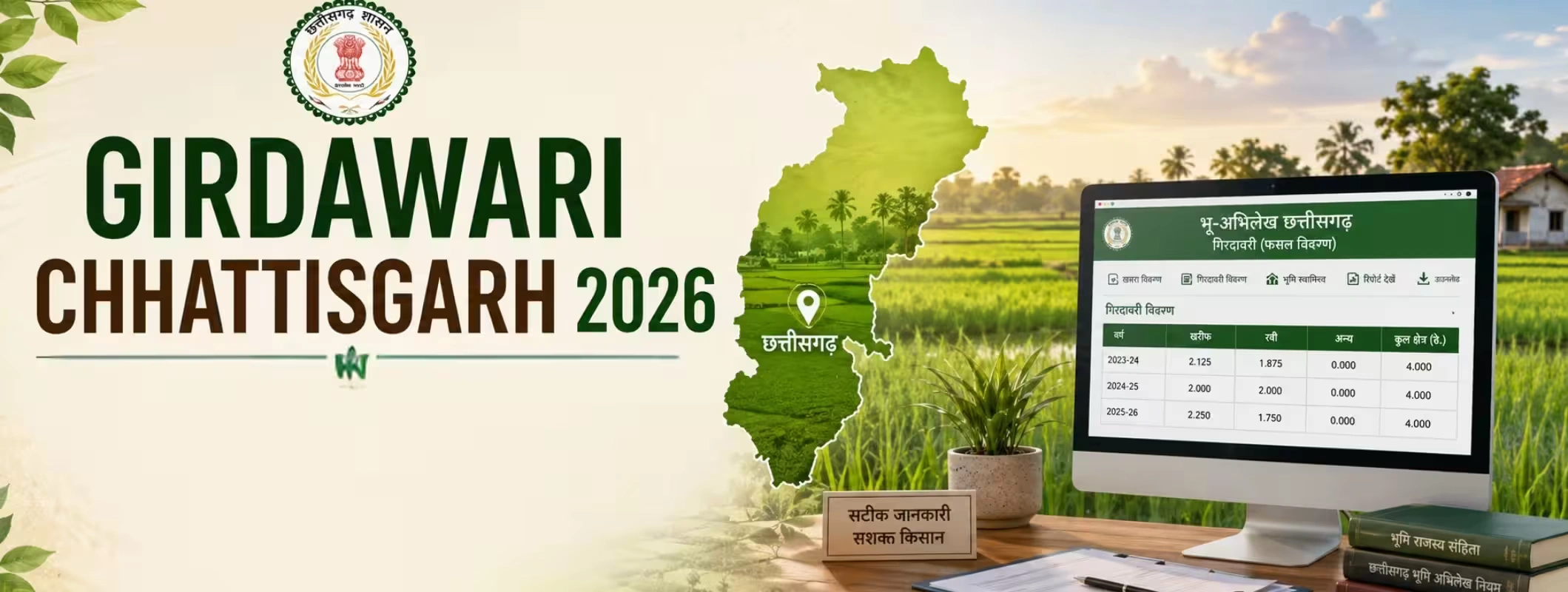
- Chhattisgarh’s Bhuiyan portal allows citizens to access Khasra details, B-I Khatauni, P-II Khasra, mutation status and crop-area reports.
- The Digital Crop Survey system collects information about crops, cultivated areas and irrigation methods using digital field-survey processes.
- Girdawari is useful for crop verification, procurement, agricultural schemes, compensation and farmland due diligence, but it is not a substitute for a registered title deed.
- Buyers should match the Girdawari entry with the Khasra number, B-I, P-II, map, ownership records, mutation history and actual field condition.
- Sellers should correct outdated crop, ownership or area information before advertising agricultural land online.
- Never pay a token amount only because a crop entry or online listing appears genuine. Complete legal and physical verification first.
What is Girdawari in Chhattisgarh?
Girdawari is the seasonal inspection and recording of crops cultivated on agricultural land. The entry generally connects the cultivated crop with a specific village, land parcel, Khasra number, agricultural season and recorded landholder.
In simple terms, Girdawari answers questions such as:
- Which crop is growing on the land?
- How much area is under cultivation?
- Is the parcel cultivated, followed or used differently?
- What type of irrigation is being used?
- Which agricultural season does the entry relate to?
The official Chhattisgarh Digital Crop Survey platform explains that its purpose is to create a clear picture of crops sown and the type of irrigation adopted. The state’s public crop-report system also allows reports to be filtered by district, tehsil, village, season, crop year and land category.
For a farmer, this may look like a routine revenue entry. In reality, an incorrect crop or area entry can create problems during crop procurement, scheme registration, compensation assessment or verification of cultivated acreage.
For a buyer, Girdawari offers another layer of information about how the land is actually being used. It may help establish whether a parcel advertised as active farmland has recently recorded cultivation. However, it does not independently prove that the person showing the land has a clear and transferable title.
Why Girdawari Matters in 2026
Land transactions are becoming more digital, but rural land verification still depends on matching online records with physical reality. A digital record may show one crop, a seller may claim another, and the actual field may be lying vacant.
This is why Girdawari should be viewed as part of a wider verification process rather than a single document that settles every question.
For farmers
A correct Girdawari entry can support the verification of:
- Cultivated crop
- Sown area
- Irrigation status
- Seasonal land use
- Crop-loss claims
- Procurement-related acreage
- Agricultural scheme eligibility
For agricultural land buyers
Anyone evaluating land in Chhattisgarh should check whether the recorded crop and cultivated area match the seller’s claims. A mismatch does not automatically make the transaction fraudulent, but it needs a clear explanation.
The crop may have changed after the survey. The field may be temporarily followed. The land may be leased informally. The entry may not have been updated. The actual cultivator may be different from the recorded owner.
Each possibility requires a different type of verification.
For landowners planning to sell
A buyer is more likely to take a listing seriously when the Khasra number, ownership details, map, land area, access road and crop information are consistent.
Trying to sell agricultural land in chhattisgarh while the records show an old owner, incorrect area or unrelated crop can delay negotiation and reduce buyer confidence.
Chhattisgarh’s Digital Land-Record System
By 2026, Chhattisgarh’s digital land ecosystem brings together different platforms and datasets. The most important systems for ordinary landowners and buyers are Bhuiyan, Bhu-Naksha and Digital Crop Survey.
Bhuiyan
Bhuiyan is the official Chhattisgarh land-record platform managed by the state’s Revenue and Disaster Management Department and hosted through the National Informatics Centre.
The platform provides access to services and information including:
- Khasra details
- B-I Khatauni and P-II Khasra
- Government Khasra information
- Mutation status
- Mutation register copies
- Civil-court case information
- Crop-wise area reports
- Landowner-wise crop-area reports
- Digitally signed land documents
The official portal states that Bhuiyan supports the maintenance of ownership and land-area information, while Bhu-Naksha manages land maps. It also notes that digitally signed documents obtained through the portal carry legal validity.
Bhu-Naksha
Bhu-Naksha helps users view the spatial location and shape of a land parcel. It is useful for understanding:
- Parcel boundaries
- Adjacent Khasra numbers
- Access position
- Shape of the plot
- Relationship with neighbouring land
- Possible boundary inconsistencies
A map should still be compared with ground demarcation. A digital outline cannot confirm that boundary stones, fencing or possession on the site match the official parcel.
Digital Crop Survey
The Digital Crop Survey captures field-level agricultural information in a more structured form. AgriStack describes digital crop surveying as an effort to improve older paper-based methods through smartphone and image-based processes.
Digital surveying may improve traceability, but it does not eliminate errors completely. Wrong parcel selection, outdated ownership linkage, field-access problems, unclear boundaries or incorrect crop identification can still create discrepancies.
Also Read: CG Bhulekh Land Records: Complete Chhattisgarh Guide
Girdawari, Khasra, B-I, P-II and Land Map: What Is the Difference?
Record | Main purpose | What buyers should check |
| Girdawari or crop entry | Shows seasonal crop and cultivation details | Crop, cultivated area, season and field condition |
| Khasra | Identifies a specific land parcel | Khasra number, area, classification and parcel details |
| B-I Khatauni | Shows landholding and ownership-related information | Recorded owner, holding details and consistency with title documents |
| P-II Khasra | Provides parcel-level land and cultivation information | Area, land category, crop entry and remarks |
| Mutation record | Shows updates made after sale, inheritance, partition or other ownership changes | Whether the current seller’s name has been entered |
| Bhu-Naksha | Shows the mapped shape and location of the parcel | Boundaries, adjoining plots, access and site position |
| Registered deed | Records the legally registered transaction | Seller’s title, transfer history, consideration and property description |
The exact layout and information displayed may vary depending on the village, crop year and record format.
Is Girdawari Proof of Land Ownership?
No. Girdawari primarily relates to cultivation and crop use. It should not be treated as independent proof of ownership.
This distinction is important because cultivation and ownership are not always held by the same person. A family member may cultivate ancestral land. A lessee may farm the parcel. A neighbour may temporarily use it. The ownership record may remain in the name of a deceased person until mutation is completed.
The official crop-survey system focuses on crop and irrigation data, while Bhuiyan separately provides ownership, landholding and digitally signed B-I/P-II records. Therefore, treating a crop entry as stand-alone title proof would be unsafe. This is a practical inference from the separate functions of these official systems.
A buyer should examine the registered title documents, revenue records, mutation entries, land map, possession and local legal restrictions together.
How to Check Girdawari in Chhattisgarh Online
The exact interface can change, but the following process reflects the structure currently available through the official state portals.
Step 1: Collect the basic land details
Before opening the portal, note down:
- District
- Tehsil
- Revenue circle, where applicable
- Village name
- Village code, if available
- Khasra number
- Recorded landowner’s name
- Crop season
- Crop year
Searching only by the owner’s name can create confusion because several people in the same village may have similar names.
Step 2: Open the official Bhuiyan portal
Use the official Chhattisgarh Revenue and Disaster Management Department’s Bhuiyan platform. Avoid entering personal information on unofficial websites that copy the portal’s design.
The Bhuiyan interface currently provides Khasra information, B-I/P-II access, mutation information and crop-related reports.
Step 3: Check the Khasra details
Select the relevant district, tehsil, village and Khasra number.
Review:
- Recorded land area
- Land classification
- Owner or landholder information
- Remarks
- Mortgage or restriction indicators, where displayed
- Parcel status
Take a screenshot or download the available report for comparison, but obtain an officially acceptable or digitally signed copy when the document is required for formal use.
Step 4: Obtain the B-I and P-II record
The official portal provides a facility for accessing digitally signed B-I Khatauni and P-II Khasra reports.
Check whether:
- The seller’s name appears correctly
- The father’s or husband’s name matches
- The Khasra number is correct
- The total area matches the seller’s claim
- Joint owners are listed
- The land category is consistent
- Crop information appears in the relevant portion
- Any remarks require further investigation
Step 5: Open the landowner-wise crop-area report
The public crop-report page allows users to select:
- District
- Tehsil
- Village
- Agricultural season
- Crop year
- Land type
- Report type
This is one of the most useful public-facing options for checking crop-area information associated with a landholder.
Step 6: Check Digital Crop Survey reports
Chhattisgarh also provides village-level reports based on Digital Crop Survey data. The report interface includes districts across the state and allows village-level crop-survey information to be accessed.
Digital Crop Survey and Bhuiyan data should be read together. One may reflect the crop-survey process, while the other connects the parcel with the wider land-record system.
Step 7: Compare the online entry with the field
This is where practical judgement matters.
Visit the land and check:
- Is the stated crop actually visible?
- Does the cultivated area appear realistic?
- Is part of the parcel occupied or uncultivated?
- Is there a water source?
- Does the field have legal and physical access?
- Are neighbouring farmers identifying the same boundary?
- Is someone other than the recorded owner in possession?
- Has a road, drain, structure or utility line affected the land?
An online entry may be correct historically but no longer reflect the current field situation.
Information You Should Verify in a Girdawari Entry
Do not stop after seeing the owner’s name. Review the entire entry carefully.
1. Khasra number
The Khasra number should match the parcel being shown on the ground. Sellers handling multiple fields sometimes share the record of the best parcel while taking buyers to a different location.
2. Crop name
Check whether the listed crop matches what was cultivated during the relevant season. Remember that Girdawari is seasonal. A Kharif entry may not represent what was grown during Rabi.
3. Cultivated area
A parcel can have a larger total area than its cultivated area. Parts of the land may contain:
- Bunds
- Trees
- Rocks
- Drainage channels
- Access paths
- Structures
- Water bodies
- Unusable slopes
Buyers often calculate returns using the total registered area without checking the net cultivable portion.
4. Irrigation details
A seller may describe land as irrigated because a borewell exists nearby. That does not prove the borewell belongs to the parcel, provides adequate water or operates throughout the year.
Check the actual source, ownership, electricity connection, water availability and distribution method.
5. Owner and cultivator details
Where the available record distinguishes ownership and cultivation, investigate any difference. It may be a normal family arrangement, lease or sharecropping practice, but it may also indicate possession issues.
6. Season and crop year
An old crop entry has limited value when assessing the land’s current condition. Always note the year and season instead of assuming the latest visible entry is current.
What to Do When Girdawari Details Are Wrong
Incorrect records should not be ignored, especially when the landowner plans to sell, apply for a scheme or use the land record for a formal purpose.
First, identify the exact discrepancy
Common problems include:
- Wrong crop
- Incorrect cultivated area
- Missing crop entry
- Wrong Khasra number
- Duplicate entry
- Outdated owner name
- Incorrect land category
- Survey linked to an adjoining parcel
- Mutation not reflected
- Joint-owner details missing
- Crop shown on uncultivated land
Collect supporting evidence
Depending on the issue, useful documents may include:
- B-I Khatauni
- P-II Khasra
- Registered deed
- Mutation order
- Inheritance documents
- Partition papers
- Current field photographs
- Previous crop records
- Sowing or input receipts
- Irrigation records
- Map copy
- Identity documents
- Application acknowledgement
Do not edit photographs or rely only on WhatsApp messages. Keep original files with dates and location details where available.
Approach the appropriate revenue authority
Start with the local Patwari or designated revenue official responsible for the village. For unresolved matters, the applicant may need to approach the Revenue Inspector, Tehsil office or another competent authority depending on the type of error.
The correction process and objection period can vary by survey cycle and district instructions. Obtain a written acknowledgement whenever an application is submitted.
Recheck after correction
Do not assume that submitting an application automatically updates every connected system. Recheck:
- Crop report
- P-II
- Mutation status
- Farmer Registry linkage
- Digital Crop Survey record
- Downloaded digital document
The national Farmer Registry framework states that Farm IDs are linked with the state Record of Rights system and that mutation can affect an existing Farm ID.
A Practical Example
Consider a landowner near Dhamtari who wants to sell a six-acre agricultural parcel.
The seller tells the buyer that the entire property is irrigated and used for paddy cultivation. The online crop report, however, reflects cultivation on only part of the recorded land.
That difference may have several explanations:
- A section may contain a pond or drainage channel.
- Part of the field may have remained fallow during the survey.
- The crop survey may have captured only one portion.
- The seller may be describing the gross area rather than the cultivable area.
- The surveyor may have selected the wrong sub-parcel.
- The seller may simply be overstating productivity.
A serious buyer should not immediately reject the property. The buyer should ask for the Khasra map, B-I, P-II, recent crop records and a joint site inspection. The net cultivable area should then be measured and verified before the price is finalised.
This is the difference between document collection and real due diligence.
Buying Agricultural Land in Chhattisgarh: Due-Diligence Checklist
A buyer looking for agriculture land for purchase should complete the following checks before paying a token amount.
Ownership and title
- Verify the original registered deed.
- Trace how the seller acquired the land.
- Check whether all legal heirs or co-owners are involved.
- Confirm that the seller’s identity matches the records.
- Review pending disputes, notices or court cases.
- Obtain an independent legal title review.
Revenue records
- Match the B-I and P-II with the registered deed.
- Check mutation status.
- Confirm the Khasra number and total area.
- Review land classification.
- Check the latest crop entry.
- Examine relevant remarks and restrictions.
Physical inspection
- Visit the exact Khasra parcel.
- Confirm access from a public or legally documented road.
- Identify boundaries with adjoining owners.
- Check encroachment and possession.
- Inspect soil, slope, drainage and waterlogging.
- Verify irrigation infrastructure.
- Calculate usable and cultivable area.
Transaction-related checks
- Confirm whether the land can legally be transferred to the proposed buyer.
- Check whether special permissions are required.
- Review mortgages, charges and third-party claims.
- Verify applicable stamp duty and registration requirements.
- Record all conditions in the agreement.
- Avoid large cash payments or undocumented advances.
Agricultural land rules are not identical across every parcel or buyer category. Protected land, government-granted land, disputed inheritance and certain community-linked holdings can require additional scrutiny. A local property lawyer and competent revenue official should review the transaction.
How Girdawari Helps in a Farmland Search
A good farmland search goes beyond price, photographs and road distance.
The Girdawari and supporting crop records may help a buyer evaluate:
- Whether the parcel has recent cultivation activity
- Which crops have been recorded
- Whether the claimed agricultural use appears consistent
- How much of the parcel may be cultivated
- Whether the land has remained fallow
- Whether the seller’s statements require further verification
Someone searching farm land for sale in chhattisgarh may see dozens of attractive listings, but crop and revenue information helps separate a visually appealing parcel from one that can realistically support the buyer’s intended use.
The record still cannot answer every investment question. It does not confirm soil fertility, market access, water yield, lease income, labour availability or future appreciation. Those factors require separate investigation.
Searching Farmland Near Me Is Only the First Step
Queries such as farmlands for sale near me, land for sale near me and plots near me for sale can help users discover nearby opportunities. They cannot complete due diligence.
Location-based results may include:
- Agricultural fields
- Converted plots
- Unapproved subdivisions
- Joint family land
- Broker-controlled listings
- Parcels without direct access
- Land with unresolved mutation
- Properties located far from the pinned map point
Always request the village name and Khasra number before travelling for a site visit. A vague location pin is not enough.
How to Sell Agricultural Land Online More Effectively
Landowners who want to sell land online should prepare the property before publishing a listing.
A serious listing should clearly mention:
- Village and tehsil
- Approximate location
- Total recorded area
- Cultivable area
- Land classification
- Water source
- Road access
- Current or recent crop
- Electricity availability
- Distance from a recognised landmark
- Ownership structure
- Whether mutation is complete
Do not upload sensitive identity documents publicly. Share complete legal papers only with genuine prospects after basic screening.
Correct records before listing
When selling property online, owners often focus on photographs and asking price while ignoring record inconsistencies. Buyers notice these problems later, usually during negotiation or legal review.
Before listing, confirm that:
- The seller’s name is updated
- Joint owners have agreed to sell
- The recorded area is correct
- Crop information is reasonably current
- The Khasra map matches the site
- Access is clearly explained
- Any existing lease or possession arrangement is disclosed
Use accurate photographs
Upload recent photographs showing:
- Entry road
- Field boundaries
- Cultivated portion
- Water source
- Electricity infrastructure
- Surrounding development
- Any pond, structure or unusable area
Avoid using generic green-field images. They may generate inquiries, but they weaken trust during the site visit.
Using Property Platforms Without Losing Control of the Transaction
Modern property listing websites make land discovery easier, but listing visibility should never be confused with legal verification.
A platform can connect buyers and sellers, organise property information and make the initial comparison more convenient. The final decision still requires document review, field verification, boundary confirmation and professional legal advice.
2Bigha can help landowners present agricultural property to relevant buyers and help buyers explore land opportunities through a structured digital experience. Users can also review its subscription plan and property management service based on their requirements.
The sensible approach is to use 2Bigha for discovery and communication while using official government records and independent professionals for verification.
Girdawari and Agricultural Investment Decisions
Interest in agricultural investments has increased among people looking for long-term land ownership, farming income, weekend agriculture or portfolio diversification.
However, a recent crop entry does not automatically make a parcel a strong investment.
Evaluate the following factors:
Water reliability
A field cultivated during one good monsoon may not support year-round farming. Check groundwater conditions, canal availability, pond ownership, pump capacity and seasonal reliability.
Net cultivable area
Price should not be evaluated only on gross acreage. Rocky portions, drainage areas, slopes, internal paths and water bodies can reduce productive land.
Access
A parcel may appear close to a highway on the map but depend on a narrow private path. Confirm legal access, not just physical access.
Crop economics
A recorded crop shows land use, not profitability. Estimate yield, input cost, labour, transport, market access and crop risk separately.
Local demand
Land near Raipur, Durg, Bilaspur or expanding corridors may behave differently from remote agricultural parcels. Yet anticipated development should never be accepted purely on a broker’s statement.
Exit potential
Before buying, consider who may purchase the land later. A parcel with clear records, proper access, manageable size and visible boundaries generally has a broader buyer base than an isolated parcel with shared access and unresolved ownership.
Common Mistakes Buyers and Sellers Make
Assuming an online record guarantees clear title
Digital records improve access to information, but they do not replace title investigation, registration documents or physical possession checks.
Checking only the owner’s name
A matching name does not confirm that the area, Khasra number, boundaries and ownership share are correct.
Ignoring joint ownership
One family member may show the property, but every required co-owner may not agree to the transaction.
Depending on old Girdawari entries
A record from an earlier crop year may not represent current cultivation or possession.
Confusing cultivated area with total area
A six-acre parcel may not provide six usable acres.
Paying before boundary verification
Boundary disputes often emerge after token payment because the buyer has already become emotionally and financially committed.
Trusting only local verbal confirmation
Neighbours and village contacts can provide useful context, but oral statements should support—not replace—official records and professional verification.
Advertising an unrealistic price
Owners sometimes set the asking price using nearby plotted-land rates even though their parcel remains agricultural, has limited access or requires legal correction. Unrealistic pricing produces inquiries but rarely produces a serious closing.
Final Girdawari Verification Checklist
Before buying, selling or investing, confirm the following:
- District, tehsil and village are correct
- Khasra number matches the site
- B-I and P-II details have been checked
- Seller’s name and ownership share are verified
- Mutation status is current
- Crop year and season are clearly identified
- Recorded crop matches the seller’s explanation
- Cultivated area has been compared with total area
- Bhu-Naksha has been reviewed
- Physical boundaries have been inspected
- Legal road access has been confirmed
- Irrigation source has been physically verified
- Joint owners and legal heirs have been identified
- Mortgage, dispute and restriction checks are complete
- A property lawyer has reviewed the title
- No major payment has been made before verification
Conclusion
Girdawari Chhattisgarh is an important record for understanding the seasonal agricultural use of a land parcel. It can help farmers identify crop-entry errors, help buyers assess cultivation claims and help sellers prepare more transparent land listings.
But Girdawari is only one piece of the puzzle.
A secure land transaction requires the crop record, Khasra, B-I, P-II, mutation status, registered deed, land map, physical boundaries, possession and legal eligibility to tell the same story. When these details do not match, stop and investigate before making a payment.
Online portals and platforms such as 2Bigha can make property discovery and listing more organised. Official government records, site inspection and independent legal review must still guide the final transaction.
Disclaimer: This article provides general information and does not constitute legal, revenue or investment advice. Portal features, correction procedures and administrative requirements may change. Confirm the latest process with the relevant Chhattisgarh revenue authority before taking action.