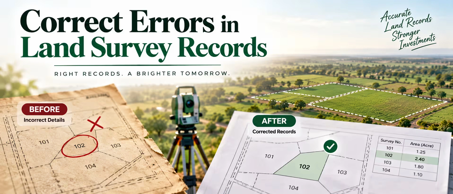
Survey records sound like the kind of bureaucratic detail nobody thinks about until it actually becomes a problem. Then, usually right in the middle of a sale or a loan application, someone pulls up the Khatauni or the survey map and notices the boundary doesn't match reality, or the area recorded is off by a few decimals, or a name from three generations ago is still sitting there like nothing ever changed. At that point, it stops being a paperwork footnote and starts being the thing holding up your transaction. The good news is that most of these errors are fixable. The process is slower than anyone would like, and it varies a fair bit by state, but it's rarely as hopeless as it feels the first time you discover the mistake.
Why These Errors Happen in the First Place?
Survey records in India go back decades, in a lot of cases well over a century, and they've passed through multiple rounds of manual measurement, colonial-era mapping, and later digitization. Each of those steps introduced its own chances for error.
- Manual measurement mistakes from the original survey, especially in hilly or irregularly shaped plots
- Clerical errors during digitization of paper records into online systems like Bhulekh or Bhu Naksha
- Boundary shifts from natural changes — river course changes, erosion, or long-term encroachment nobody corrected in the records
- Inheritance splits that were never formally updated in the mutation records
- Simple transcription mistakes — a transposed number, a misspelled name, a wrong survey number carried over from an old document
None of these are unusual. They're common enough that most long-held agriculture land in India has at least some minor discrepancy somewhere in its record history. The problem only becomes urgent when you're trying to sell, mortgage, or subdivide, and the records suddenly need to hold up to scrutiny.
The Common Types of Errors
Before walking into a revenue office, it helps to know exactly what category your error falls into, because the correction process differs depending on the type, even when you're handling online land selling and related property records.
| Error Type | Example | Typical Fix Route |
|---|---|---|
| Clerical/typographical | Misspelled owner name, wrong survey number | Application for correction at Tehsil/revenue office |
| Area discrepancy | Recorded area doesn't match actual measured area | Re-survey request, sometimes with a licensed surveyor |
| Boundary mismatch | Neighboring plot boundaries overlap or conflict | Joint measurement (demarcation) with adjoining owners |
| Outdated ownership | Records still show a deceased or previous owner | Mutation (Dakhil Kharij) application |
| Missing or incorrect classification | Land wrongly marked as non-agricultural or vice versa | Application to the revenue/land records department |
Getting this classification right upfront saves a lot of back-and-forth, since each error type is handled by a slightly different office process, and walking in with the wrong application form is a common reason corrections get delayed for months.
Step-by-Step: Correcting a Survey Record Error
1. Get a certified copy of the current record.
Pull the existing Khatauni, Jamabandi, or equivalent state record, along with the survey map (Shajra or equivalent). You need this as your baseline before you can prove anything is wrong.
2. Identify and document the discrepancy clearly.
Compare the recorded details against the actual physical situation — measured boundaries, current ownership, correct classification. Photographs, old sale deeds, and inheritance documents all help build your case.
3. File a formal correction application.
This typically goes to the Tehsildar or the local revenue office, depending on the state. Most states now also accept applications through their online land records portal, which tends to move faster than a purely paper-based submission.
4. Attend the field verification, if required.
For boundary or area disputes specifically, a revenue official (often a Patwari or equivalent) will usually conduct a physical measurement or demarcation, sometimes with neighboring landowners present to confirm agreement on the new boundary.
5. Wait for the order and updated record.
Once verified, the office issues a correction order, and the record gets updated in the system. Always request a fresh certified copy afterward to confirm the fix actually reflects in the official database, not just in a physical file somewhere.
6. Cross-check that the digital record matches the physical order.
This step gets skipped more than it should. Digitized records occasionally lag behind or misrepresent the correction order, so it's worth checking the online portal a few weeks later to make sure everything synced properly.
What You'll Typically Need to Submit?
Requirements shift by state, but most correction applications ask for some combination of the following.
- Existing survey record or Khatauni copy showing the error
- Proof of ownership — sale deed, inheritance documents, or mutation records
- Identity proof of the applicant
- A written application stating the nature of the error and the correction requested
- Supporting evidence — old maps, photographs, or a licensed surveyor's report for boundary and area disputes
- No-objection confirmation from adjoining landowners, in cases involving boundary changes
Keeping a complete folder of these documents from the start avoids the frustrating cycle of repeated office visits that a lot of applicants get stuck in simply because one document was missing.
When to Bring In a Licensed Surveyor?
Not every error needs professional surveying, but boundary and area discrepancies almost always benefit from one. A licensed surveyor can produce a measurement report that carries weight with the revenue office, rather than relying purely on the department's own field staff, whose measurements can themselves sometimes be the source of the original error. This step costs money upfront, but for anyone planning to list crop land for sale or hold onto the plot as a long-term asset, resolving a boundary ambiguity properly tends to pay for itself the first time a serious buyer runs their own due diligence.
How Record Errors Affect a Sale?
This is where the issue stops being theoretical for most people. A buyer's lawyer, or increasingly a verification process built into online listing platforms, will check survey and revenue records as a standard step. If there's a mismatch, one of a few things usually happens.
- The buyer asks for the correction to be completed before proceeding, which can delay closing by weeks or months
- The buyer negotiates a lower price to account for the perceived risk
- In more cautious cases, the buyer walks away entirely rather than deal with unresolved records
If you're actively trying to sell land or planning to list farm land for sale in the near future, it's worth checking your survey records well before you start fielding offers, not after a buyer's due diligence flags the issue and stalls everything.
Selling While Records Are Being Corrected
Sometimes the correction process is underway but not finished, and a genuine buyer is still interested. This isn't automatically a dealbreaker, but it needs to be handled transparently.
- Disclose the pending correction upfront rather than letting the buyer discover it independently
- Provide documentation showing the correction application has been filed and where it stands
- Some buyers are willing to proceed with an escrow arrangement tied to resolution of the correction
- Others will simply wait, particularly if the land itself is otherwise attractive
Trying to push a sale through while hoping nobody checks the records rarely ends well, and it tends to damage trust badly enough that even a willing buyer backs out once they sense something was withheld.
Getting It Right Before You List
If you're in the early stages of preparing agriculture land for the market, whether that's a straightforward plot or something you're marketing as farm land for sale near me on a local listing, running a records check before you list saves a lot of friction later. It's a lot easier to fix a clerical error quietly in advance than to explain it mid-negotiation to a buyer who's already nervous about the paperwork.
This is also where selling property online through a verified platform tends to work better than informal channels. Platforms like 2Bigha build background and documentation verification into the listing process itself, which means record issues tend to surface early, while there's still time to fix them, rather than after a buyer has already gotten emotionally invested and then walked away over something that could have been resolved beforehand.
Disclaimer: This article is for informational purposes only and should not be considered investment, legal, financial, or property advice. Real estate regulations, infrastructure plans, market conditions, and government policies may change over time. Readers are advised to verify information with relevant authorities and consult qualified professionals before making any investment or property-related decisions.