Ask anyone who's dealt with a property dispute in Tamil Nadu, and they'll usually point to the same culprit: a survey number that doesn't quite match what's on the ground. It's an old problem. Boundaries drawn decades ago, sometimes during British-era surveys, just haven't kept pace with how land actually looks today. Rivers shift course, plots get divided among heirs, and somewhere along the way, paper records stop reflecting reality.
That's the backdrop against which Tamil Nadu's government kicked off a fresh, technology-driven land survey. And if you're currently browsing land for sale in Tamil Nadu, or thinking about parting with a family plot, this is worth understanding properly, not just skimming.
The Problem With the Old Survey System
For years, Tamil Nadu relied on manual chain surveys. Picture a surveyor walking a field with a measuring chain, jotting numbers into a register by hand. It worked, sort of, but it left plenty of room for error. Add in decades of inheritance splits, encroachments, and the occasional clerical slip, and you get a records system riddled with inconsistencies. This became a real headache for anyone trying to buy farmland in Tamil Nadu. A buyer might be shown one boundary on-site, while the government record tells a different story. Bank loans got delayed. Litigation dragged on for years. Something had to give.
What's Different About the New Process?
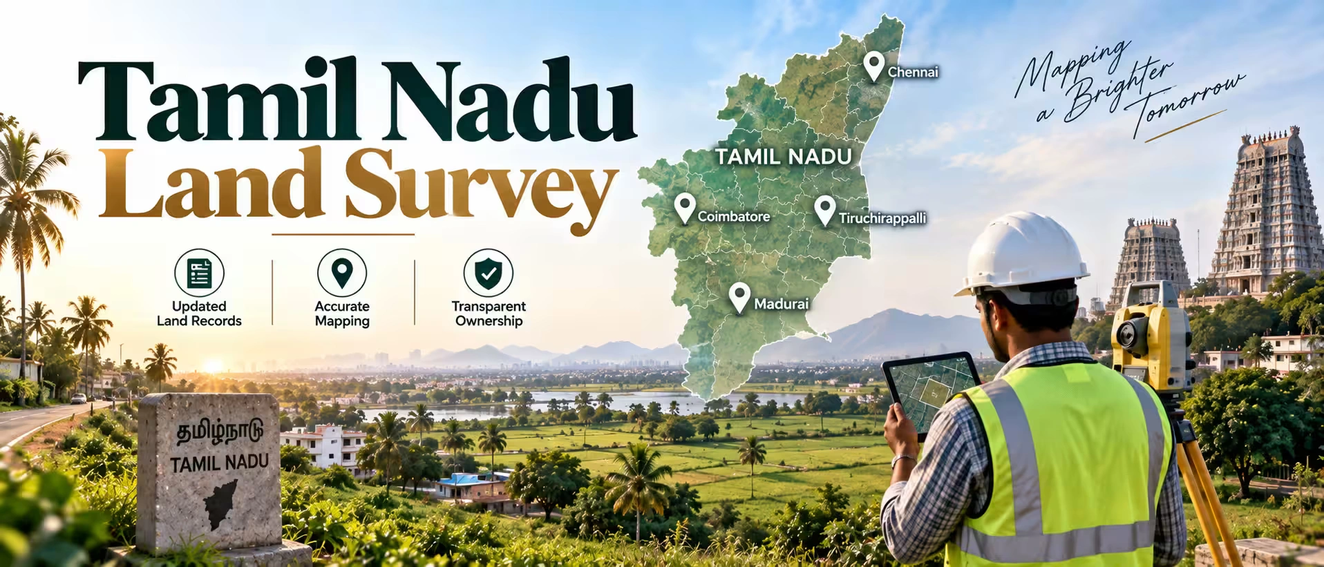
The state didn't just tweak the old system; it rebuilt large parts of it. Drones now fly over plots to capture aerial measurements. GPS-based reference stations, known as CORS (Continuously Operating Reference Stations), pin down coordinates with startling precision, often within a few centimetres. Old Field Measurement Books, the paper registers that recorded plot dimensions, are being scanned and digitized so they can be cross-checked against fresh survey data. There's also a public objection window built into the process. Once a draft map is ready, landowners get a window to flag errors before anything is locked in as final.
Quick comparison — old system vs new system:
| Feature | Earlier Method | Current Method |
| How boundaries were measured | Chain and manual tools | Drone imagery + GPS/CORS |
| Record storage | Paper-based, prone to damage | Digital, backed up online |
| Precision | Rough, error-prone | Centimetre-level accuracy |
| Checking your record | Physical visit to the revenue office | Online through TNREGINET |
| Fixing errors | Slow manual verification | Objection window + faster review |
TNREGINET 2026: Why Is It Suddenly So Useful?
Here's the thing about TNREGINET: it existed before, but it's only recently become genuinely useful for everyday buyers and sellers, not just lawyers and registration clerks. Heading into 2026, the portal has tightened its integration with survey records, patta and chitta data, and encumbrance certificates. What can you actually do on it?
- Pull up an Encumbrance Certificate for a specific property
- Check patta and chitta details tied to a survey number
- See the government guideline value used for stamp duty
- Track where a document registration currently stands
- Match survey sub-division numbers against updated FMB sketches
Document/Detail | Where It's Used |
| Encumbrance Certificate (EC) | Confirms the property is free of legal claims |
| Patta/Chitta | Establishes ownership and land classification |
| Guideline Value | Used to calculate stamp duty and registration fee |
| FMB Sketch | Shows exact survey boundaries and sub-divisions |
| Registration Status | Tracks the progress of an ongoing document filing |
If you're actively hunting for land in Tamil Nadu, this portal removes a lot of guesswork. You don't have to take a broker's word for it anymore; you can verify the paperwork yourself, from your phone, before you even visit the site.
How to Check Survey Details: A Rough Walkthrough?
- Head to the official TNREGINET website.
- Look for the section that lets you view patta/chitta or EC records.
- Punch in the district, taluk, village, and survey number.
- Compare what's shown against the physical boundaries you were shown at the site visit.
- Save or download the certificate; you'll need it for your lawyer anyway.
- Spotted a mismatch? Take it up with the local Village Administrative Officer or the Taluk office directly.
It sounds simple enough, and mostly it is. Though I'd be lying if I said the portal never lags during peak hours, especially around festival season when registrations spike.
Buying Farmland? Here's Where Surveys Matter Most
Agricultural land brings its own set of complications. Whether a plot is classified as wet or dry land, what water rights come attached, whether it's been converted from agricultural to non-agricultural use, all of this traces back to the survey record.
If your plan is to buy farmland in Tamil Nadu, don't just rely on what a seller or local agent tells you about the acreage. Numbers get rounded up in conversation more often than you'd think. Pull the actual survey sketch and check it against what's being shown to you physically. It takes maybe twenty extra minutes and can save you from a very expensive mistake.
Selling Land? Get Your Records in Order First
On the flip side, if you're planning to sell land in Tamil Nadu, having your documents squared away before you even list the property changes how quickly things move. Buyers today, particularly those coming through organized platforms or agencies, tend to do their homework before making an offer. A seller who can hand over a clean EC, a current FMB sketch, and a patta record that actually matches gives buyers one less reason to hesitate or haggle. If your land's survey record hasn't been touched since an older government survey, get it checked now rather than scrambling when a buyer's lawyer raises a red flag mid-deal.
Gaps That Still Exist
The new system is a big improvement, but it's not flawless yet, especially for people looking to sell land in Tamil Nadu.
| Issue | Why It Still Happens |
| Boundary mismatches in rural plots | Some areas haven't been re-surveyed with drones yet |
| Multiple subdivisions on one original plot | Common after generational inheritance splits |
| Portal slowdowns | Heavy traffic during peak registration months |
| Delayed correction updates | Objection window closed, but the fix is still processing |
Worth knowing these upfront so you're not caught off guard assuming every record online is instantly perfect.
Why Does This Matter for Land Investment in the State?
Tamil Nadu keeps attracting investment, industrial corridors, IT growth around Chennai and Coimbatore, and a steady infrastructure push across smaller towns too. None of that growth means much if the land title underneath it is shaky. Accurate, digitized survey records are what actually make that growth safe to invest in, whether you're a local buyer or someone looking in from another state. If you're comparing different pockets of land in Tamil Nadu, treat the survey verification step as something you simply don't skip. It's not glamorous work, but it's the difference between a smooth purchase and a decade-long court case.
Final Word
Tamil Nadu's move toward drone-based, digitized land surveys is more than a bureaucratic refresh; it's genuinely addressing decades of disputes that have made property transactions messier than they needed to be. Whether you're scanning listings for land for sale in Tamil Nadu, working out the details to buy farmland in Tamil Nadu, or preparing to sell land in Tamil Nadu that's been sitting in your family for years, lean on TNREGINET 2026 before you sign anything. It's a bit of extra effort now, but it beats years of legal back-and-forth later.
Disclaimer: This article is for informational purposes only and should not be considered investment, legal, financial, or property advice. Real estate regulations, infrastructure plans, market conditions, and government policies may change over time. Readers are advised to verify information with relevant authorities and consult qualified professionals before making any investment or property-related decisions.