If you are planning to buy land online, You searched for the property. The photos look good, the price seems reasonable, and the listing says it's very close to a highway. But is that really all the information about land? This is where most land buyers get confused. Do you trust a satellite image and move forward, or do you book a flight, drive down those thin roads, and see the land with your own eyes? Both approaches have different steps. The important thing is knowing what each one can, and can't, tell you. This article will help you with that.
Why This Question Matters More Than You'd Think
Buying land is not the same as buying a phone off a website. You can't return it if it doesn't match the description. A wrong assumption about soil quality, access roads, or boundary lines can cost you lakhs, sometimes even more than that. Technology has made remote land evaluation possible in ways it wasn't ten years ago. Satellite imagery, drone footage, and mapping tools have now changed the process of how people shortlist properties. But none of that replaces walking the land yourself. At least, not completely. So which one should you rely on? Honestly, it depends on what stage of buying you're at.
What Satellite Images Can Actually Show You?
Satellite images are great for the first initial stage of buying. They're fast, free (mostly), and let you scan a huge area without leaving your desk. Below is what they're genuinely useful for:
- Topography – you can spot slopes, low-lying areas, or uneven terrain
- Vegetation cover – green patches vs bare land tells you a lot about usage history
- Proximity to roads and infrastructure — distance to highways, towns, or rail lines
- Water bodies nearby – ponds, rivers, or irrigation channels are usually visible
- Neighboring land use – is it surrounded by farms, factories, or residential plots?
If you're comparing five different plots in various parts of two states, satellite imagery saves you weeks of travel. You can rule out clearly unsuitable land before wasting a single rupee on fuel or flight tickets.
Where Satellite Images Fall Short?
They can't tell you the soil's actual fertility. A part of the green from above might just be weeds, not crops. They also can not tell you about the legal disputes, encroachments, or whether the access road is a public right of way or someone's private driveway that they'll block the moment you buy. And resolution matters. Free tools like Google Earth often have very old images, sometimes two or three years old. A lot must have changed on a piece of land in that time.
What a Physical Site Visit Reveals That a Screen Never Will?
There's a reason experienced investors still insist on visiting land before signing anything. A site visit can tell you a lot of information that no camera, drone, or satellite can capture.
Soil Quality and Texture
You can dig a small hole, check moisture retention capacity, and even talk to local farmers about what grows well there. No image gives you that.
Real Accessibility
Google Maps might show a road leading to the plot. But is it paved? Does it flood during monsoon? Is it wide enough for a tractor, let alone a truck? You only find out by driving it yourself.
Boundary Verification
Satellite images blur property lines, especially in areas without proper survey markers. Walking the actual boundary with a local surveyor avoids future conflicts.
Talking to Locals
This one's underrated. A five-minute chat with a nearby farmer or shopkeeper often reveals things no document will: water table issues, past floods, or even pending litigation on the land.
Smell, Sound, and Feel
This might sound unusual, but it matters. Is there a factory nearby releasing fumes? Is a highway too close, meaning constant noise? These details rarely show up in listings.
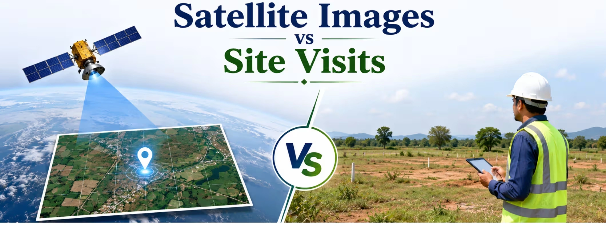
Satellite Images vs Physical Site Visits: A Quick Comparison
| Factor | Satellite Images | Physical Site Visit |
|---|---|---|
| Cost | Low / Free | Higher (travel, time) |
| Speed | Instant | Takes days |
| Soil Quality Check | Not possible | Fully possible |
| Legal Verification | Not possible | Partially possible |
| Terrain & Topography | Good overview | Detailed, ground-level |
| Boundary Accuracy | Approximate | Precise (with surveyor) |
| Local Insights | None | Valuable |
| Best Used For | Initial shortlisting | Final decision-making |
Both method are irreplaceable. Smart buyers use both: satellite images to narrow down options, and a site visit to confirm before any money changes hands.
How to Combine Both Methods When You Buy Land?
If you're planning to buy land in India, here's a really good approach that saves both time and regret.
- Start broad, use satellite imagery to shortlist 5–10 plots across your target area.
- Eliminate options with obvious red flags (flood zones, poor road access, isolated location)
- Narrow it down to 2–3 serious contenders
- Visit each one physically, ideally with a local agent or surveyor
- Only finalize the deal after both digital and physical checks line up
This two-step filter is especially useful if you're comparing land across multiple cities — say, if you want to purchase land in Pune but you're also considering options to buy farmland in Bangalore.
Location-Specific Considerations
Land for Sale in Hyderabad often comes with rocky terrain in certain belts, something satellite images show clearly, but soil suitability for farming still needs an on-ground check.
If you're eyeing a plot for sale in Gujarat, especially near coastal belts, checking salinity and irrigation access in person is non-negotiable; no image can measure that.
And if you're trying to sell land in Bangalore, buyers today expect both a well-documented satellite overview along with an invitation to visit before they commit.
Common Mistakes Buyers Make
A few patterns show up again and again:
- Relying only on outdated satellite images without checking the actual date of capture
- Skipping the site visit because "it looked fine online"
- Not bringing a local surveyor during the visit
- Ignoring seasonal changes; land can look very different in monsoon vs summer
- Trusting listing photos without verifying they match the actual plot's GPS coordinates
Avoiding these mistakes mainly leads to one thing: patience. Rushing a land deal because a photo looked convincing is how most buyer regrets start.
How 2Bigha Bridges the Gap Between Digital and Physical Verification?
This is exactly the problem 2Bigha was built to solve. It's an AI-powered platform focused entirely on agricultural land and farmland across India, and it brings satellite-backed insights together with verified, on-ground listing data. Instead of guessing whether a plot's satellite image is recent or accurate, 2Bigha combines mapping technology with verified documentation, so when you're browsing land for sale in India, you're not working off guesswork alone. A few things that make really useful for buyers and sellers:
- AI-driven analysis of terrain, location, and surrounding land use
- Verified listings, reducing the risk of outdated or misleading photos
- Support for both parties, whether you want to buy land or sell land quickly
- A single platform to compare options if you're deciding between a farmland for sale in Gujarat listing and one to purchase land in Pune
It doesn't replace the site visit; nothing should. But it makes sure the digital groundwork you do beforehand is actually reliable, so your physical visit is spent confirming details, not discovering surprises.
Conclusion
Satellite images and physical site visits aren't competitors; they're two halves of the same process. One gives you speed and a wide-angle view. The other gives you truth, texture, and the details that only show up when your feet are actually on the ground. If you're serious about buying agricultural land, don't skip either step. Use satellite tools to shortlist smartly, then visit in person before you commit. That combination is still the safest way to buy land, no matter how good the technology gets.
Disclaimer: This article is for informational purposes only and should not be considered investment, legal, financial, or property advice. Real estate regulations, infrastructure plans, market conditions, and government policies may change over time. Readers are advised to verify information with relevant authorities and consult qualified professionals before making any investment or property-related decisions.