Key Takeaways
- BhuNaksha West Bengal is commonly searched by land buyers, sellers, landowners, and property consultants who want to view land maps, plot boundaries, and Mouza-level land details online.
- In West Bengal, the official land-record journey mainly works through the Banglarbhumi portal, where users can check West Bengal land records, plot information, Khatian details, and map-related services.
- To check a West Bengal land map online, you usually need basic location details such as district, block, Mouza, Dag number, Plot number, or Khatian number.
- A Banglarbhumi land map or Banglarbhumi plot map helps you understand the approximate land parcel location, survey reference, and plot identity, but it should not replace legal verification, physical survey, or ownership due diligence.
- Always verify land before buying West Bengal, especially when you are checking land for sale in West Bengal, agricultural land for sale in West Bengal, farmland, rural plots, or investment land.
- Before you buy land in West Bengal, use online records to check plot maps before buying land, confirm ownership documents, review mutation status, and inspect the site physically.
- 2Bigha supports land discovery, land listing visibility, and practical land comparison for buyers and sellers who want a more organized way to search, compare, and manage land opportunities across India through a simple membership plan.
What Is BhuNaksha West Bengal?
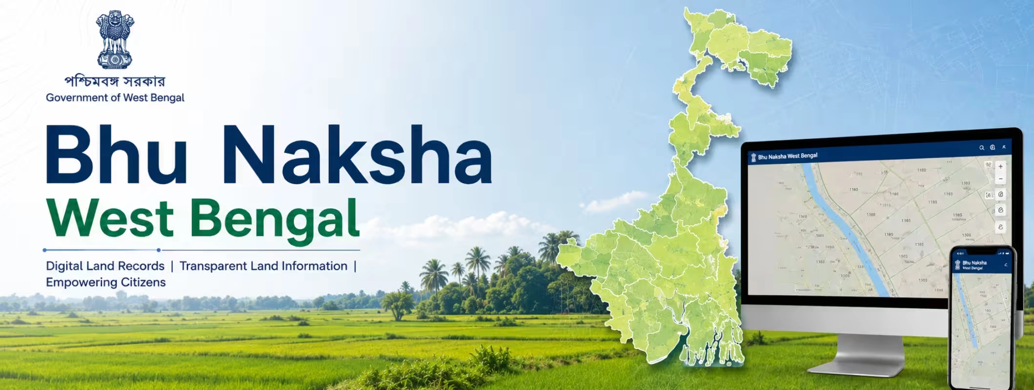
BhuNaksha West Bengal can be explained as a digital land-map system or online land-map search method that helps users find land plot information or land information at the Mouza level. In simple terms, the system lets users know about the location, identity in government land records, and relationship with other plots, boundaries, road connectivity, and surveys regarding a particular piece of land.
The search intent of many users is to find Bhu Naksha West Bengal when they wish to see a property map in order to buy land, sell land, verify their family property, verify their agricultural land, or learn about their disputed plots. Clearly, the intent of searching Bhu Naksha West Bengal is to find a reliable means for viewing West Bengal plot map or Mouza map West Bengal online.
As far as land record experience in West Bengal is concerned, Banglarbhumi is directly linked to it. The use of Banglarbhumi is necessary to get services like Khatian and plot information, Mouza information, RS-LR information, plot map application, Mouza map application, mutation status, and so forth. It implies that whenever users search for Bhu Naksha West Bengal, what they actually seek is Banglarbhumi land map.
For all the parties involved, be it purchasers, sellers, landowners, or consultants, this is highly relevant. The land map may help you establish the location of your land, but having the land map does not guarantee the ownership of the land. You should examine everything, including the map, deed, encumbrance, access, use, and boundaries, before deciding anything serious.
Why Is BhuNaksha West Bengal Important for Land Buyers and Sellers?
Land is not like a flat in a gated apartment where the boundary is already visible through walls, floors, and sanctioned layouts. In rural areas, peri-urban belts, agricultural pockets, and village Mouzas, land identity depends heavily on survey numbers, plot numbers, Dag numbers, Khatian records, Mouza maps, and local boundary recognition.
That is why BhuNaksha West Bengal is useful. It gives a map-based starting point for understanding a plot.
If you are planning to buy land in West Bengal, a land map helps you check whether the seller is showing the same plot that appears in land records. If you want to sell land in West Bengal, a clear map reference can help serious buyers understand the location faster. If you are comparing farmland for sale in West Bengal, map-based verification can reduce confusion between nearby plots.
A West Bengal land map online can help with:
- Checking the approximate location of a land parcel
- Matching the plot with the correct Mouza
- Reviewing land identity through Dag number or Plot number
- Understanding surrounding land parcels
- Supporting basic land due diligence
- Reducing confusion during land visits
- Preparing questions for the seller, broker, patwari-level contact, lawyer, or land consultant
- Comparing land options before shortlisting
However, a map should be treated as a verification support document, not the final proof of clean ownership. For any land investment in West Bengal, you should use maps with legal documents, title checks, mutation records, registration records, tax receipts, and physical surveys.
BhuNaksha West Bengal vs Banglarbhumi land map: What Is the Difference?
Many people use the terms BhuNaksha West Bengal, Banglarbhumi land map, and West Bengal land map online as if they mean the same thing. In practical user search behavior, they are closely related, but the actual service path may differ.
Here is a simple comparison:
| Term | What Users Usually Mean | Best Use |
| BhuNaksha West Bengal | Online map of land parcel or cadastral map in West Bengal | To search land-map information and understand plot location |
| Banglarbhumi land map | Land map or plot map service connected with the Banglarbhumi portal | To access official West Bengal land-record and map-related services |
| Banglarbhumi plot map | Plot-level map connected with Dag/plot details | To identify a specific plot within a Mouza |
| Mouza map West Bengal | Map of a village/revenue area showing multiple land parcels | To understand the larger land layout of a Mouza |
| West Bengal plot map online | Digital plot map search for a land parcel | To check plot shape, location reference, and surrounding plots |
| West Bengal land records map | Map connected with land-record data | To support ownership and land parcel verification |
So, when you search for how to check BhuNaksha West Bengal, the practical answer is: start with the official land-record system, use the required district/block/Mouza details, and verify the plot through Banglarbhumi-linked services.
What Details Do You Need to Check a West Bengal land map online?
Before opening the portal, keep your land details ready. This saves time and prevents wrong searches.
You may need:
- District name
- Block or municipality details
- Mouza name
- Dag number or Plot number
- Khatian number
- Owner name, if available
- RS or LR reference, if mentioned in old records
- Deed details, if you are verifying a purchased property
- Mutation details, if ownership has changed recently
- Local address or landmark for physical verification
For rural land and agricultural plots, the most important combination is usually district + block + Mouza + Dag number. For ownership-related details, the Khatian number becomes important. For historical or converted land records, RS LR plot information may also matter.
If you are dealing with agricultural land for sale in West Bengal, ask the seller for the exact Mouza, plot/Dag details, Khatian details, land classification, land area, and mutation status before making any payment.
How to Check BhuNaksha West Bengal Online?
Here is a simple user-friendly process to check land maps online in West Bengal. The portal layout may change over time, but the basic search logic usually remains the same.
Step 1: Visit the Official Banglarbhumi portal
Start with the official Banglarbhumi portal. Avoid depending only on random third-party screenshots or unofficial apps. Third-party platforms may simplify access, but for final verification, always cross-check with the official source.
Step 2: Go to Land Information or Citizen Services
Look for land-record or citizen-service options such as Khatian and plot information, plot map request, Mouza map request, or related land services.
If you are only checking basic land details, start with Khatian and plot information. If you need a map document, look for plot map or Mouza map services.
Step 3: Select District, Block, and Mouza
The portal will usually ask you to select the district, block, and Mouza. This is important because the same plot number may exist in different Mouzas. Never search only by number without confirming the location.
For example, a buyer searching for BhuNaksha Howrah, BhuNaksha Hooghly, BhuNaksha North 24 Parganas, or BhuNaksha South 24 Parganas must still select the correct Mouza. District-level selection alone is not enough.
Step 4: Search by Dag number, Plot number, or Khatian number
Once you select the location, use the available search option. You may search by Dag number, Plot number, or Khatian number, depending on the service available.
If your goal is to verify a specific land parcel, use the plot/Dag option. If your goal is to check ownership-related land records, use the Khatian option.
Step 5: Review Plot Details Carefully
Check the land details shown on the screen. Review the plot number, Khatian details, land classification, area, owner details, and other available information.
Do not rush here. If the seller claims one land parcel but the portal shows a different area, different classification, or unclear ownership reference, stop and verify further.
Step 6: Use Plot Map or Mouza Map Request If Required
If you need a map document, use the available plot map or Mouza map service. Depending on the service, login, application, fee payment, or request tracking may be required.
This is useful when you want to download land map West Bengal, request a Banglarbhumi plot map, or review a West Bengal Mouza map online before site inspection.
Step 7: Save or Download the Record
If the portal allows download, save the map or record for your due diligence folder. Keep the file name clear, such as district_mouza_plotnumber_date. This helps when you share it with a lawyer, buyer, seller, surveyor, or land consultant.
How to Check Plot Map by Dag number in West Bengal?
Many land buyers ask: “Can I check the plot map by Dag number West Bengal?”
Yes, the Dag number is one of the most important identifiers for checking plot-related land information in West Bengal. A Dag number helps identify a specific land parcel within a Mouza. When you combine the correct district, block, Mouza, and Dag number, you can reach more accurate plot information.
Follow this process:
- Open the Banglarbhumi portal.
- Choose the land-record or plot-information option.
- Select district, block, and Mouza.
- Choose search by plot/Dag, if available.
- Enter the Dag number.
- Review the plot information.
- Use map request services if you need a map copy.
This is especially useful when you are reviewing land for sale in West Bengal and the seller gives you a Dag number. But do not stop at online checking. Match the Dag number with the deed, Khatian, mutation record, tax receipt, site location, and physical boundary.
How to Download Banglarbhumi plot map or Mouza map West Bengal?
Users often search for how to download land map West Bengal or Banglarbhumi plot map download. The process depends on the map type and availability.
A plot map usually focuses on a specific land parcel. A Mouza map shows a larger revenue village area with multiple plots. If you want to understand surrounding plots, roads, canals, land clusters, and nearby parcels, a Mouza map is more helpful.
To request or download a map:
- Visit the official Banglarbhumi portal.
- Login or create an account if required.
- Go to citizen services or service delivery.
- Select plot map request or Mouza map request.
- Enter district, block, Mouza, and plot details.
- Choose the correct map type, if the option appears.
- Submit the request and complete the required process.
- Track the request status.
- Download the map if the service allows digital delivery.
If your land has old records, check whether RS or LR map references are needed. In many cases, RS LR plot information West Bengal helps users compare old and updated survey references.
What Is a Mouza Map and Why Does It Matter?
A Mouza map is a cadastral-style map of a revenue village or Mouza. It shows land parcels within that area and helps identify how individual plots are positioned in relation to one another.
For land buyers, a Mouza map matters because the local land identity in many parts of West Bengal is built around Mouza-level records. Even when someone says the land is near a road, pond, village, market, or highway, you still need the official Mouza and plot reference.
A Mouza map West Bengal can help you:
- Understand plot location within the village layout
- Check whether the plot is landlocked or accessible
- Compare nearby plots and boundaries
- Identify possible approach roads
- Review land parcel shape
- Support discussion with surveyors and legal advisors
- Avoid confusion between similar plot numbers
If you are checking plots for sale in West Bengal, especially in rural or semi-rural areas, ask for the Mouza name first. Without the correct Mouza, the plot number alone may mislead you.
What Is a Khatian Number?
A Khatian number is a land-record reference linked to ownership or rights information. It helps identify whose name appears in the land record and how the land is recorded.
In West Bengal, buyers often use Khatian details along with plot/Dag details to verify whether the person selling the land has a proper recorded connection with the property. This is important because many land disputes happen when the person showing the land is not the clear recorded owner, or when inheritance, mutation, partition, or co-sharer issues are pending.
When checking check Khatian and plot information West Bengal, compare:
- Owner name
- Khatian number
- Plot/Dag number
- Land area
- Land classification
- Mutation status
- Deed details
- Seller identity documents
A clean-looking online record is helpful, but land buying still needs legal due diligence.
What Is RS LR plot information in West Bengal?
RS LR plot information refers to the relationship between Revisional Settlement and Land Records references. In simple terms, older survey records and newer land records may use different plot references. RS-LR checking helps connect old plot numbers with updated land-record references.
This becomes important when:
- The seller has old documents
- The deed mentions RS details
- The current record uses LR details
- There has been resurvey or record correction
- Land has changed classification or ownership
- The buyer wants to compare old and current records
When you check RS LR plot information West Bengal, you reduce the risk of relying only on outdated numbers. This is especially useful for inherited land, old agricultural land, and plots that have passed through multiple family transfers.
District-Wise Use: Where Can Users Search BhuNaksha West Bengal?
Users search for BhuNaksha West Bengal across many districts and land markets. The process generally depends on district, block, and Mouza selection.
Common searches include:
- BhuNaksha Kolkata for urban and peri-urban land references
- BhuNaksha Howrah for industrial, residential, and mixed-use property checks
- BhuNaksha Hooghly for land around growing town and village belts
- BhuNaksha North 24 Parganas for high-demand land near Kolkata’s expanding edges
- BhuNaksha South 24 Parganas for agricultural, residential, and riverine land pockets
- BhuNaksha Nadia for village and farmland verification
- BhuNaksha Murshidabad for rural and agricultural land records
- BhuNaksha Bardhaman for industrial and agricultural land belts
- BhuNaksha Siliguri for land around North Bengal’s growth corridor
- BhuNaksha Darjeeling for hill-region land reference checks
- BhuNaksha Malda for agricultural and settlement land records
- BhuNaksha Bankura and BhuNaksha Purulia for rural, farmhouse, and land-investment interest
For every district, remember one thing: district name alone is not enough. A proper search needs Mouza-level accuracy. That is why West Bengal land map district wise searches should always move deeper into block, Mouza, plot, Dag, and Khatian details.
Why Land Maps Matter Before Buying Land in West Bengal
Buying land is emotional in India. Families buy land for farming, a future home, a farmhouse, business use, retirement planning, or long-term appreciation. But emotion should not replace verification.
Before you buy land in West Bengal, a map-based check can show whether the plot shown by the seller matches the land-record identity. It can also help you ask better questions during a site visit.
For example, if a seller shows you a plot near a road, but the West Bengal plot map online suggests the actual land parcel is behind another plot, the access may not be as clear as claimed. If the seller says the land is agricultural, but the land record or local classification suggests another use, you need clarification. If the plot is irregular in shape, the usable area may be different from what you assumed.
That is why smart buyers always check plot maps before buying land. This one step can protect you from wrong-location claims, unclear access, boundary confusion, and misleading listing information.
Land Verification Checklist Before Buying Land in West Bengal
Use this checklist before finalizing any land for sale in West Bengal, farmland, agricultural plot, or village land.
| Verification Point | What to Check | Why It Matters |
| Plot/Dag details | Match Dag number with land records | Confirms the land parcel identity |
| Khatian details | Check Khatian number and owner information | Helps verify recorded rights |
| Mouza details | Confirm district, block, and Mouza | Prevents wrong-location searches |
| Land map | Review Banglarbhumi plot map or Mouza map | Helps understand boundaries and surroundings |
| Land classification | Check if land is agricultural, residential, commercial, etc. | Affects usage, conversion, and valuation |
| Mutation status | Check whether ownership change is updated | Reduces ownership-risk confusion |
| Deed records | Match seller documents with registration details | Supports title due diligence |
| Physical boundary | Inspect site with local survey support | Online maps may not show ground reality fully |
| Access road | Confirm legal and practical access | Landlocked plots can be difficult to use or sell |
| Encumbrance/legal risk | Lawyer-led verification | Helps avoid disputes and hidden claims |
This checklist is useful for buyers, sellers, brokers, land consultants, NRIs, and families dealing with inherited land. It also helps anyone doing land ownership verification in West Bengal before payment.
Common Mistakes People Make While Checking West Bengal land records
Online land records are helpful, but many users make avoidable mistakes. Here are the most common ones.
1. Searching by Plot Number Without Mouza
A plot number without Mouza can create confusion. Similar numbers may exist in different Mouzas. Always select the correct district, block, and Mouza first.
2. Treating Map View as Final Ownership Proof
A property map of West Bengal may help you understand location, but ownership depends on land records, deed history, mutation, legal title, and other documents. Do not treat a map as full proof of ownership.
3. Ignoring Physical Site Verification
Online records may show one thing, but the ground situation can be different. Boundary disputes, encroachments, missing access roads, and informal possession issues require physical verification.
4. Not Checking Co-Owners or Inheritance Issues
Many rural lands have multiple heirs or co-sharers. A single seller may not have full rights to sell the entire land. Always check ownership and consent carefully.
5. Not Matching RS and LR References
Old documents may mention one survey reference, while newer records may show another. RS LR plot information helps bridge this gap.
6. Trusting Only Broker Claims
A broker may know the location, but legal and map verification should still happen independently. For serious land investment in West Bengal, never depend only on verbal claims.
How BhuNaksha West Bengal Helps Sellers
Land sellers also benefit from map-based records. When you want to sell land in West Bengal, buyers will ask for proof, location clarity, and documentation. A proper plot map, Mouza reference, and land record information can make your listing more trustworthy.
A seller can use map-based information to:
- Explain exact land location
- Share Mouza and plot details
- Reduce buyer confusion
- Support transparent communication
- Attract serious buyers
- Avoid repeated basic questions
- Build trust before site visits
If you are listing agricultural land for sale in West Bengal, provide accurate plot details, land area, access information, nearby landmarks, and available records. Serious buyers prefer verified information over vague promises.
How 2Bigha Makes Land Discovery Easier
Searching land online in India is still difficult because many listings do not provide proper plot details, map clarity, ownership context, or local verification support. A buyer may see a good-looking listing, but the real questions start later: Where exactly is the plot? Is the seller genuine? What is the land type? Is the location practical? Can the buyer compare similar land options?
This is where 2Bigha adds value.
2Bigha is built around map-based land discovery, farmland visibility, and practical land comparison for Indian buyers and sellers. Instead of treating land like a normal classified listing, 2Bigha focuses on location clarity, land details, buyer-seller connection, and better discovery for people looking at rural plots, farmland, agricultural land, and investment land.
For buyers, 2Bigha can help shortlist land opportunities with better location understanding. For sellers, it can improve listing visibility and help reach serious buyers beyond the local broker network. For landowners, it supports a more organized way to present land details and build buyer confidence.
If you are exploring land for sale in West Bengal or planning to sell land in West Bengal, use official records for verification and use platforms like 2Bigha for discovery, comparison, and listing support through a simple subscription plan.
Best Use Cases of Banglarbhumi land map for Buyers
A Banglarbhumi land map is useful in many practical situations.
For First-Time Land Buyers
If you are buying land for the first time, maps help you understand the plot location before you visit the site. You can ask better questions and avoid blindly trusting verbal directions.
For Farmland Buyers
When checking farmland for sale in West Bengal, use maps to understand plot shape, nearby access, village location, and whether the land appears practical for farming or future use.
For NRIs and Outstation Buyers
If you live outside West Bengal, online maps and records can help you shortlist properties before sending someone for a site visit. Still, final verification should happen through a trusted local person, surveyor, or legal expert.
For Family Property Checks
Many families use online land records to understand inherited land. A Khatian number, Dag number, and Mouza details can help identify land parcels before partition discussions.
For Land Dispute Prevention
Boundary confusion is common in land matters. A map can support discussion, but formal surveys and legal documents are needed in disputes.
What Online Land Maps Can and Cannot Do
A West Bengal land map online is useful, but it has limits. This section is important for real-world decision-making.
Online Land Maps Can Help You:
- Identify plot location
- Understand Mouza-level land layout
- Match plot/Dag details
- Support preliminary due diligence
- Compare surrounding land parcels
- Prepare for a site visit
- Ask better questions to the seller
- Organize land documents
Online Land Maps Cannot Fully Confirm:
- Clear title
- Legal ownership
- Seller authority
- Family consent
- Encumbrance status
- Court disputes
- Actual ground possession
- Boundary encroachment
- Road access rights
- Conversion permission
- Future development approval
So, use BhuNaksha West Bengal and Banglarbhumi plot map as the first layer of verification, not the final decision.
When Should You Consult a Land Expert?
You should consult a land consultant, surveyor, or property lawyer when:
- The land has multiple owners
- The seller is not the recorded owner
- Mutation is pending
- Plot size does not match the deed
- Boundary is unclear
- Road access is not documented
- Land is under conversion
- The property is inherited
- There is a dispute or objection
- You are investing a large amount
- You are buying agricultural or rural land from outside the district
A professional can compare the West Bengal land records, deed, mutation, land map, tax receipt, and actual site condition. This is the safest approach before large payments.
Quick Summary: How to Check Land Map Online in West Bengal
Here is the simple version for voice search and quick users:
To check BhuNaksha West Bengal online, visit the official Banglarbhumi portal, choose the land-record or map-related service, select district, block, and Mouza, then search using Dag number, Plot number, or Khatian number. Review the plot details carefully and request the plot map or Mouza map if needed. Before buying land, match the online map with ownership records, mutation details, deed history, and physical boundary verification.
Final Thoughts
BhuNaksha West Bengal makes land-map checking easier for buyers, sellers, landowners, and consultants. But land is a high-value asset, and one wrong assumption can create legal, financial, and emotional stress.
Use the Banglarbhumi land map, plot details, Mouza map, Khatian information, and RS-LR references as your first step. Then verify ownership, title, mutation, access, boundaries, and ground reality before payment.
If you are planning to buy land in West Bengal, do not rely only on a broker’s words. If you want to sell land in West Bengal, make your listing more transparent with clear land details and map references. And if you are exploring digital land discovery, 2Bigha can help you compare land opportunities, improve listing visibility, and approach land buying or selling with more clarity.
The smart rule is simple: check the map, verify the record, inspect the land, and then decide.