Key Takeaways
- Before buying agricultural land, farmland, farmhouse land, or a rural plot in India, never depend only on the seller’s words or a broker’s location pin. You must verify the land map, ownership records, mutation status, boundaries, access road, and legal title.
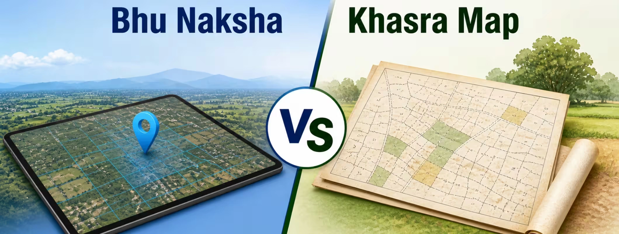
- Bhu Naksha is mainly the online digital cadastral map system used to view plot boundaries and parcel-level map details. NIC describes Bhu-Naksha as an Indian cadastral mapping solution developed to support digitized cadastral map management.
- Khasra Map usually refers to a revenue/cadastral village map where land parcels are identified with khasra or survey numbers. The khasra number helps identify a specific land parcel in rural land records.
- For a safe land purchase, match the Bhu Naksha map, khasra number, jamabandi/khatauni/Record of Rights, mutation records, sale deed, encumbrance certificate, and physical site boundaries.
- Online land records are useful, but they are not a replacement for legal due diligence, site inspection, and official verification from the revenue department.
- Platforms like 2Bigha can help buyers explore land through map-based discovery, land price visibility, ownership-oriented insights, and verified listings. Sellers, agents, and landowners can also use the 2Bigha subscription plan to improve listing visibility and attract more relevant land buyers.
Introduction: Why Land Map Verification Matters Before Buying Land
Buying land in India looks simple on the surface. You find a plot, visit the site, negotiate the price, check the basic documents, and move toward registration. But land deals are rarely that simple.
A plot may look clean on the ground, but the revenue map may show a different boundary. The seller may show a khasra number, but the land may be divided, disputed, under mutation, jointly owned, landlocked, or different from the area shown on paper. In many cases, buyers discover the problem only after paying token money or signing an agreement. This is where land map verification becomes important.
Two words which confuse land buyers are 'Bhu Naksha' and 'Khasra Map'. These terms are used interchangeably by many, but they do not mean the exact same thing. While both these terms have something to do with the land record system in India, there is a slight difference between the two.
If you are planning to buy verified land, invest in farmland, sell legal property or study the land ownership documents, you should know how Bhu Naksha and Khasra Map complement each other.
What is Bhu Naksha?
Bhu Naksha meaning: Bhu Naksha is an online digital land map system that shows cadastral maps, plot boundaries, land parcel details, and survey/khasra-linked map information for many states in India.
In simple words, Bhu Naksha helps you view a land parcel on a digital map. You can usually select the state, district, tehsil, village, and plot/khasra number to view the parcel boundary. In many states, the Bhu Naksha portal also lets users download or print plot reports.
The official Bhu-Naksha platform is described as a cadastral mapping solution developed by NIC for digitized cadastral map management, while the Digital India Land Records Modernization Programme focuses on modernizing land records and improving transparency in land record systems.
What Does Bhu Naksha Usually Show?
The exact information depends on the state portal, but Bhu Naksha may show:
Bhu Naksha Detail | Why it Matters for Buyers |
| Plot boundary | Helps you understand the shape and limits of the land parcel |
| Khasra/survey number | Helps match the map with land records |
| Village and tehsil details | Confirms the administrative location |
| Adjacent plots | Helps identify neighbouring parcels and access issues |
| Land parcel area | Helps compare map area with sale deed and revenue records |
| Map report | Useful for initial due diligence and discussion with legal experts |
Bhu Naksha is highly useful for verify plot map online, checking approximate boundaries, and understanding whether the plot shown by the seller matches the official land map.
But be careful: an online Bhu Naksha view should not be treated as the final legal proof of ownership. It is one important part of land due diligence India, not the complete answer.
What is a Khasra Map
Meaning of khasra map: It means the Revenue Map or Cadastral Map which denotes the land parcels through Khasra Numbering System. For example, in many states in north India, Khasra Numbering is used as a parcel identification system for agricultural lands.
What is a Khasra Number? Khasra Number is an individual identification number in land revenue records for identifying land. Purchasers use Khasra Number, Khata Number, Khatauni Number, Khewat Number, or Owner's Name while searching for land information from the respective portal.
For example, Haryana’s official Jamabandi portal allows users to search land records by owner name, khewat, khasra/survey number, and mutation date. It also states that digital Record of Rights is available and generated in real time.
What Does a Khasra Map Help You Check?
A khasra map helps you understand:
Khasra Map Detail | Buyer Use |
Khasra number | Confirms the exact land parcel in revenue records |
Plot location within village map | Helps identify the parcel’s position |
Boundary and neighbouring numbers | Helps check access, encroachment, and landlocked risk |
Division/subdivision | Helps identify if the land has been split |
Revenue map reference | Helps compare with jamabandi, khatauni, mutation, and sale deed |
In short, a khasra map helps answer a basic but critical question: Is the land being shown to you the same land recorded in government revenue records?
Bhu Naksha vs Khasra Map: Main Difference
The easiest way to understand the difference is this:
Bhu Naksha is the digital platform or online map system. Khasra Map is the land parcel map/revenue map that uses khasra numbers to identify plots.
Both are connected, but they are not the same thing.
Bhu Naksha vs Khasra Map Comparison Table
| Point of Difference | Bhu Naksha | Khasra Map |
| Basic Meaning | Online digital cadastral map system | Revenue/cadastral map showing land parcels with khasra numbers |
| Main Purpose | To view land parcel boundaries online | To identify land parcels in village revenue maps |
| Format | Usually digital/online | Can be digital or physical revenue map |
| Used For | Plot map verification, boundary view, map report | Khasra number search, parcel identification, revenue record matching |
| Best For Buyers | Checking the shape, boundary, and location of a plot online | Matching the land parcel with ownership and revenue records |
| Ownership Proof? | No, not by itself | No, not by itself |
| Must Be Matched With | Jamabandi, khatauni, mutation, sale deed, EC, site visit | Bhu Naksha, Record of Rights, mutation, sale deed, demarcation |
| Risk If Ignored | Wrong boundary, wrong plot location, encroachment risk | Wrong khasra number, disputed parcel, title mismatch |
Simple Example: How Both Work Together
Suppose a seller says:
“This farmland is Khasra No. 142/2, area 1.5 acres, located in Village X.”
As a buyer, you should not stop there.
You should check:
- Does Khasra No. 142/2 exist in the revenue record?
- Who is the recorded owner?
- Is the seller’s name in jamabandi, khatauni, or Record of Rights?
- Does mutation reflect the latest ownership?
- Does the Bhu Naksha boundary match the physical plot shown on site?
- Is the area in the map close to the area mentioned in the documents?
- Is there legal access from a road?
- Are there any encroachments, disputes, restrictions, or land-use issues?
This is why Bhu Naksha vs Khasra Map is not just a technical comparison. It directly affects your money, legal safety, and future resale value.
Why Land Buyers Should Not Rely Only on One Document
Many buyers make the mistake of checking only the sale deed. Some check only the khasra number. Some only see the online map. None of these alone is enough.
Land ownership in India is record-based and state-specific. The terms also change by state. In Haryana, you may hear Jamabandi, Khewat, Khatauni, and Khasra. In Karnataka, buyers often check RTC/Pahani, mutation, EC, and survey details. In Maharashtra, 7/12 extract and mutation entries are common. In other states, land record names may differ.
The broader land record modernization effort under DILRMP aims to modernize records, reduce land/property disputes, and enhance transparency, but buyers still need to verify state-specific records carefully.
So, for safe property verification, treat every document as one piece of the puzzle.
What is a Cadastral Map
Cadastral map is a map that depicts details of land plots, including their boundary lines and plot identifiers like khasra or survey numbers. This is different from Google Maps pin.
Google maps may depict road network, surrounding features, and satellite image of the area, but this does not confirm legal boundary limits of the land plot. Cadastral map is related to revenue records.
For land buyers, a cadastral map helps with:
- Plot boundary verification
- Khasra number search
- Checking neighbouring parcels
- Identifying access road issues
- Comparing physical possession with official map boundaries
- Understanding subdivision or merger of land parcels
This is why the Bhu Naksha online check is useful before buying land.
How to Check Bhu Naksha Online
The process differs by state, but the general steps are similar.
Step 1: Visit the Official State Bhu Naksha Portal
Search for your state’s official Bhu Naksha or land records portal. Avoid random third-party websites for final verification. Use official state portals wherever available.
Step 2: Select Location Details
You will usually need to select:
- State
- District
- Tehsil/Taluk
- Village
- Plot number, khasra number, or survey number
Step 3: Open the Village Map
Once the village map loads, locate the relevant plot number. Some portals allow you to click directly on the map.
Step 4: Check Plot Details
Review the plot number, area, boundary, and neighbouring plots.
Step 5: Download or Print the Map Report
If the portal allows, download the map report and keep it with your due diligence file.
Step 6: Match It With Other Documents
Do not stop at the map. Match the Bhu Naksha details with:
- Sale deed
- Khasra details
- Khatauni/Jamabandi/Record of Rights
- Mutation records
- Encumbrance certificate
- Physical site survey
- Demarcation report, if needed
This process supports better legal land verification and reduces the risk of buying the wrong parcel.
How to Read a Khasra Map
A khasra map can look confusing if you are seeing it for the first time. It may show irregular plot shapes, numbers, boundaries, paths, water bodies, and neighbouring lands.
Here is how to read it in a practical way.
- Identify the Correct Village: Khasra numbers are village-specific. The same khasra number may exist in another village, so always confirm the village name, tehsil, and district.
- Match the Khasra Number: Find the khasra number mentioned in the sale deed, jamabandi, khatauni, or seller documents.
- Check the Boundary Shape: Compare the map shape with the land shown physically. If the seller shows a rectangular plot but the map shows an irregular parcel, ask questions.
- Check Neighbouring Khasra Numbers: Neighbouring parcels help you confirm whether you are standing on the right plot.
- Check Road Access: A plot may look attractive, but if there is no recorded access road, resale and development can become difficult.
- Check Area Consistency: The area shown in the map, revenue records, sale deed, and physical measurement should broadly match. Small differences may happen due to survey methods, but major differences are a red flag.
Documents to Check Along With Bhu Naksha and Khasra Map
A smart land buyer does not verify only the map. You need a full document check.
Plot Document Checklist Before Buying Land
| Document | What It Confirms |
| Sale deed/title deed | Ownership transfer history |
| Mother deed/title chain | Previous ownership flow |
| Jamabandi/Khatauni/Record of Rights | Current recorded ownership and land details |
| Khasra details | Specific land parcel identification |
| Mutation record | Whether ownership change is updated in revenue records |
| Encumbrance Certificate | Loans, charges, or registered liabilities |
| Bhu Naksha/Revenue map | Plot boundary and map position |
| Demarcation report | Actual boundary measurement on ground |
| Land-use certificate/zoning check | Whether the land can be used for your intended purpose |
| Conversion order, if applicable | Permission to change agricultural land to non-agricultural use |
| Tax receipts | Payment history and possession support |
| Court/dispute check | Litigation or claim risk |
| Road access proof | Legal entry to the land |
| NOC, if required | Approvals based on state and land type |
This is the minimum buyer-side approach for property verification documents. For high-value land, always involve a local property legal consultant or land records consultant.
Common Mistakes Buyers Make During Land Map Verification
Mistake 1: Trusting Only the Broker’s Location Pin
A WhatsApp location is not a legal boundary. It can help you reach the site, but it cannot prove the khasra boundary.
Mistake 2: Checking Ownership but Ignoring the Map
The seller may be the owner of land in that village, but the plot shown to you may not be the same parcel mentioned in the documents.
Mistake 3: Ignoring Mutation Records
Mutation does not create title by itself, but it is important for revenue record updates. If mutation is pending, disputed, or not in the seller’s name, investigate further.
Mistake 4: Not Checking Joint Ownership
Many agricultural lands are inherited and jointly owned. If all legal owners do not sign the sale deed, the transaction can become disputed later.
Mistake 5: Not Checking Access Road
Land without legal access may become difficult to use, sell, finance, or develop.
Mistake 6: Assuming Online Records Are Always Updated
Online land records are improving across India, but delays, errors, old entries, and pending updates can still exist. Always cross-check with the revenue office where needed.
Red Flags in Bhu Naksha and Khasra Map Verification
Avoid moving forward blindly if you notice these signs:
Red Flag | What it May Mean |
| Seller shows one plot, map shows another | Wrong parcel or intentional misrepresentation |
| Khasra number does not match ownership record | Possible title issue |
| Area differs heavily across documents | Measurement or subdivision problem |
| Land is jointly owned but only one person is selling | Consent issue |
| Mutation is pending or disputed | Ownership update risk |
| No access road in map | Landlocked plot risk |
| Boundary overlaps with neighbouring land | Encroachment or survey issue |
| Seller avoids official demarcation | Possible hidden boundary problem |
| Land use does not match buyer’s purpose | Conversion or approval risk |
| Property has unclear title chain | Future legal dispute risk |
Bhu Naksha vs Khasra Map: Which One Is More Important?
Both are important, but they answer different questions.
Bhu Naksha answers:
Where is the plot located on the official digital map, and what does its boundary look like?
Khasra Map answers:
Which khasra/survey number identifies the land parcel in the village revenue map?
Ownership records answer:
Who legally appears as the owner or recorded holder?
Mutation records answer:
Has the latest ownership change been updated in revenue records?
Sale deed answers:
What registered transaction created or transferred ownership?
So, the correct approach is not choosing one over the other. The correct approach is matching all records together.
Buyer’s Land Verification Process Before Purchase
Here is a practical flow for land due diligence in India.
Step 1: Collect Basic Property Details
Ask the seller for:
- Village name
- Tehsil/taluk
- District
- Khasra/survey number
- Khata/khatauni/khewat number, if available
- Total area
- Owner names
- Sale deed copy
- Mutation copy
- Revenue record copy
Step 2: Check Online Land Records
Use the relevant state portal to check ownership, khasra map details, mutation status, and Record of Rights. For example, Haryana’s Jamabandi portal supports searches by owner name, khewat, khasra/survey number, and mutation date.
Step 3: Verify Bhu Naksha
Check whether the map boundary matches the plot being sold.
Step 4: Visit the Site
Compare the digital map with actual ground boundaries, fencing, trees, roads, canals, neighbouring plots, and landmarks.
Step 5: Ask for Official Demarcation
For agricultural land or large plots, demarcation by the revenue department or licensed surveyor can reduce boundary disputes.
Step 6: Check Title and Encumbrance
Ask a legal expert to review title chain, registered deeds, EC, litigation, restrictions, and land-use rules.
Step 7: Check Land Use and Conversion Rules
If you want to build a farmhouse, warehouse, resort, commercial activity, or plotted project, check whether the land-use category allows it. Agricultural land cannot automatically be used for non-agricultural purposes.
Step 8: Register Only After Clear Verification
Do not pay major money before document clarity. Use proper agreement terms, payment records, and registered documentation.
Role of 2Bigha in Safer Land Discovery
Traditional land buying in India is often scattered. Buyers depend on local brokers, word-of-mouth, incomplete records, and unclear site details. This creates confusion, especially for agricultural land, farmland, farmhouse plots, and rural investments.
2Bigha is built for land discovery. It helps buyers explore land through map-based search, price visibility, property insights, and land-focused listings. Its platform highlights land search, investment opportunities, ownership-related insights, and map-based exploration.
For sellers, agents, and landowners, 2Bigha also provides digital selling support. The 2Bigha sell page positions the platform around selling agricultural land or farmland with confidence, and its subscription plan can help sellers improve listing visibility and reach more relevant buyers.
That said, buyers should still complete legal verification before purchase. A verified listing or online property check improves discovery, but final due diligence should include legal review, revenue record checks, map verification, and site inspection.
When Should You Hire a Land Verification Expert?
You should consider a property legal consultant or land due diligence expert if:
- The land value is high
- The seller is not the recorded owner
- The property is inherited or jointly owned
- The khasra number has been subdivided
- Mutation is not updated
- The land is near a highway, industrial corridor, or urban expansion zone
- The land is agricultural but your purpose is non-agricultural
- There is no clear road access
- The seller is pushing for quick token money
- Documents are incomplete or handwritten with unclear entries
Professional land verification services may cost money, but they can save you from bigger losses.
Summary Table: What Buyers Should Verify
| Verification Area | Document/Tool to Use | Why it Matters |
| Plot boundary | Bhu Naksha, cadastral map, demarcation | Confirms physical limits |
| Parcel identity | Khasra map, khasra number search | Confirms correct plot |
| Ownership | Jamabandi/khatauni/RoR, sale deed | Confirms seller rights |
| Ownership update | Mutation record | Confirms revenue update |
| Liabilities | Encumbrance certificate | Checks loans/charges |
| Land use | Zoning/conversion records | Confirms allowed usage |
| Access | Map, site visit, revenue path record | Prevents landlocked risk |
| Dispute risk | Court search, local inquiry | Avoids litigation |
| Marketability | Clear title, approved documents | Supports resale and investment security |
Final Words
The difference between Bhu Naksha and Khasra Map is simple but important. Bhu Naksha helps you view the land map digitally. A Khasra Map helps identify the land parcel through revenue survey numbers. But neither one alone proves a clean title.
Before buying land, check the map, khasra details, ownership records, mutation records, sale deed, encumbrance certificate, land use, and physical boundaries. If even one major detail does not match, pause the deal and verify further.
For Buyers, the safest land is not just cheap land. It is land with clear title, correct boundaries, legal access, verified records, and realistic future use.
For Sellers, clean documents and better visibility matter. Listing land on platforms like 2Bigha and using a subscription plan for better reach can help attract more serious buyers, especially when the property has approved documents and transparent details.
FAQs: Bhu Naksha vs Khasra Map
1. What is the main difference between Bhu Naksha and Khasra Map?
Bhu Naksha is usually the online digital map system used to view land parcel boundaries. A Khasra Map is a revenue or cadastral map where land parcels are identified using khasra or survey numbers. Buyers should use both for land map verification.
2. Is Bhu Naksha proof of land ownership?
No. Bhu Naksha shows land parcel maps and boundaries, but it is not complete proof of ownership. You must also check the sale deed, Record of Rights, jamabandi or khatauni, mutation records, and encumbrance certificate.
3. What is a khasra number?
A khasra number is a land parcel identification number used in rural revenue records in many Indian states. It helps identify a specific plot within a village.
4. Can I check Bhu Naksha online?
Yes, many states provide online Bhu Naksha or digital cadastral map portals. You usually need to select the district, tehsil, village, and plot/khasra number to view the land map.
5. What documents should I check before buying land?
You should check the sale deed, title chain, Record of Rights, jamabandi or khatauni, mutation record, khasra details, Bhu Naksha, encumbrance certificate, tax receipts, land-use approval, conversion order if applicable, and road access proof.
6. Can online land records be wrong?
Yes, online records can sometimes be outdated, incomplete, or under correction. Always cross-check with official revenue records, site inspection, and legal due diligence.
7. Why is plot boundary verification important?
Plot boundary verification helps confirm that the land shown by the seller matches the official cadastral map and revenue record. It also helps detect encroachment, wrong possession, and access road issues.
8. Should I buy land if mutation is not updated?
Be careful. Mutation does not create ownership by itself, but it shows whether the latest ownership change has been updated in revenue records. If mutation is pending or disputed, consult a legal expert before paying.
9. Can I use Google Maps instead of Bhu Naksha?
No. Google Maps can help with location and nearby roads, but it does not prove legal land boundaries. Use Bhu Naksha, khasra map, revenue records, and official demarcation for land verification.
10. How can 2Bigha help in buying or selling land?
2Bigha.ai helps users explore agricultural land, farmland, and plots through map-based listings, price visibility, and property insights. Sellers, agents, and landowners can also use the 2Bigha subscription plan to improve listing visibility and reach more relevant buyers.