Key Takeaways
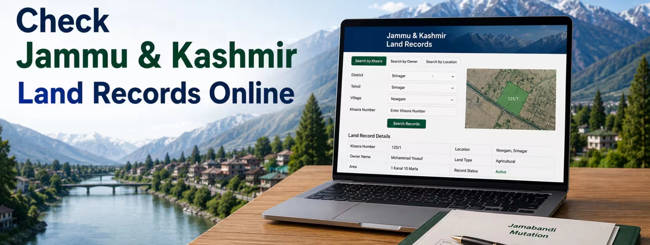
Bhu Naksha Jammu & Kashmir is a common search term used by people who want to check land maps, khasra maps, village maps, and plot-level details online in J&K.
Jammu & Kashmir may not work exactly like states that have a separate public Bhu Naksha portal. For J&K land records, users should mainly rely on the official J&K Land Records & Grievance Portal, revenue records, Jamabandi details, and local Tehsil verification.
A Jammu Kashmir land map online can help you understand a land parcel’s location, village, khasra number, boundary reference, and nearby parcels, but it should not be treated as final legal proof of ownership.
Before you buy land in Jammu Kashmir, always verify Jamabandi, khasra number, mutation status, land use, road access, ownership chain, registration details, and any dispute or restriction.
If you are checking land for sale in Jammu Kashmir, agricultural land for sale in J&K, or a plot for sale in Jammu Kashmir, a map-based search can reduce confusion, but final due diligence must be done through official records and local revenue authorities.
2Bigha helps land buyers and sellers explore land opportunities with a more organized, map-first approach, especially when users want better clarity before shortlisting or listing land through a subscription plan.
Introduction: Why People Search for Bhu Naksha Jammu & Kashmir
Acquisition of any piece of land in Jammu & Kashmir is no easy task. Every land has certain attributes, including location, boundaries, khasra number, ownership status, land classification, mutations, approach road, and revenue identification of local area. A minor discrepancy with the number of khasra or name of the village will pose significant complications while purchasing or selling land, inheriting, availing a loan, or settling any property disputes.
This is the reason why so many people search for Bhu Naksha Jammu & Kashmir, Bhu Naksha J&K, Jammu Kashmir land map online, or Khasra Map Jammu Kashmir. The reason behind all this is very basic – Is it possible to get access to the land map online without physically going to the revenue office?
The answer to the question is yes, though there are caveats. In this case, the procedure is somewhat different from others in other Indian states as far as the public Bhu Naksha map is concerned. People in J&K should verify their land records, Jamabandi, village-level records, and even Tehsil level maps where required.
This guide will cover everything about checking online land maps for Jammu Kashmir – from what information is available on these maps to how you can efficiently use your digital land record knowledge when buying/selling land.
What Is Bhu Naksha?
Bhu Naksha means “land map.” In Indian land-record systems, Bhu Naksha usually refers to a digital cadastral map that shows land parcels at village level. A cadastral map is not a tourist map or a normal Google Map. It is a revenue map that shows plots, khasra numbers, boundaries, and parcel divisions used by the revenue department.
In simple words, Bhu Naksha helps users identify:
- Where a land parcel is located
- Which khasra number belongs to which parcel
- How the plot is positioned inside the village map
- Which land parcels are nearby
- Whether a parcel has visible boundary references
- How the land record connects with village revenue data
For states where a public Bhu Naksha portal is active, users can usually select district, tehsil, village, and khasra number to view a plot map. For Jammu & Kashmir, users should be careful because the land-record access system may work differently from other states.
Important Clarification: Is There a Separate Bhu Naksha J&K Portal?
This is the most important point for users.
Many people search for Bhu Naksha Jammu & Kashmir or Bhu Naksha JK, expecting a separate public map portal like some other states. However, Jammu & Kashmir may not provide the same direct public Bhu Naksha experience in the way users expect from states like Rajasthan, Bihar, UP, or Maharashtra.
For J&K, the safer approach is:
- Use the official J&K Land Records & Grievance Portal for Jamabandi and land-record access.
- Check available land-record details using district, tehsil, village, and khasra-related information.
- For map-level verification, contact the concerned Patwari, Tehsil office, or revenue authority.
- Use digital map references only as an initial check, not as final legal confirmation.
- Verify ownership and boundaries through certified documents before any transaction.
This honest clarification is important because many unofficial websites and apps may use the term “Bhu Naksha J&K” to attract traffic, but land buyers should trust only government sources, certified documents, and verified property professionals.
Why Land Maps Matter in Jammu & Kashmir
The reason behind Jammu & Kashmir’s exclusive land market scenario is that it contains urban land, village land, agricultural land, orchards, hills, tourism related land, and land around infrastructural developments. If one needs to verify a land map of Jammu, Srinagar, Anantnag, Baramulla, or Udhampur, then verification becomes imperative.
A land map helps buyers and sellers understand the physical and revenue identity of a property. This is especially useful when a person is searching for land for sale in Jammu Kashmir, farmland for sale Jammu Kashmir, or agricultural land for sale in J&K.
A proper land map check can help answer practical questions like:
- Is the land parcel actually located where the seller claims?
- Does the khasra number match the village record?
- Is the land connected to a road or access path?
- Are nearby plots private, government, forest, or community land?
- Is the boundary clear on the revenue map?
- Does the area mentioned in the document match the local record?
- Is the land suitable for agricultural, residential, commercial, or investment use?
For buyers, a map reduces guesswork. For sellers, it improves trust. For investors, it helps compare location potential before shortlisting.
Key Land Record Terms You Should Know Before Checking Bhu Naksha J&K
Understanding land-record language makes the process easier. Here are the terms commonly used in Jammu & Kashmir land records and village maps.
| Term | Simple Meaning | Why It Matters |
| Khasra Number | A plot or survey number given to a land parcel | Used to identify a specific land parcel in village records |
| Jamabandi | Record of rights showing ownership and revenue details | Important for checking ownership and land classification |
| Khatauni | Record linked with cultivators or landholders | Useful in rural and agricultural land verification |
| Mutation | Update in ownership record after sale, inheritance, gift, or transfer | Confirms whether ownership change is reflected in revenue records |
| Cadastral Map | Revenue map showing land parcels and boundaries | Helps identify plot position and nearby parcels |
| Girdawari | Crop and possession-related record | Useful for agricultural land checks |
| ULPIN | Unique Land Parcel Identification Number | Helps create a unique identity for land parcels through geo-referenced systems |
| Tehsil | Revenue administrative unit | Most land verification and certified record checks happen here |
If you are planning to buy land in Jammu Kashmir, these terms are not optional. You must understand them or work with someone who can read and verify them properly.
How to Check Land Records and Land Maps Online in Jammu & Kashmir
The online process may change with government updates, but the general user journey remains similar. Follow this practical method.
Step 1: Visit the Official J&K Land Records Portal
Start with the official Jammu & Kashmir land records platform. Avoid relying on random third-party websites that ask for unnecessary payment, personal information, or document uploads.
Look for services related to:
- View Jamabandi
- Land records
- Revenue records
- Grievance submission
- Grievance tracking
- District, tehsil, and village-wise land details
The official system is mainly useful for checking Jamabandi and land-record information. If map-level details are not visible for a specific village or parcel, visit the concerned revenue office for verification.
Step 2: Select District, Tehsil, and Village
Land records are organized by location. You may need to select:
- District
- Tehsil
- Village
- Land record type
- Khasra number or owner-related details, where available
For example, a user checking land map Jammu may need to choose Jammu district, then the relevant tehsil and village. Similarly, someone checking land map Srinagar, land map Pulwama, land map Budgam, or land map Kathua must select the correct administrative location.
Do not assume that two villages with similar names are the same. Always confirm spelling and tehsil.
Step 3: Enter Khasra Number or Search Land Details
If you already have the khasra number, the search becomes easier. A khasra number is one of the most important identifiers for checking rural and village land records.
You may search using:
- Khasra number
- Village details
- Owner details, if allowed
- Jamabandi record
- Khata or khatauni reference, where applicable
If you are checking land before purchase, ask the seller for the correct khasra number. If the seller avoids sharing it, treat that as a warning sign.
Step 4: Check Jamabandi Details
Jamabandi is one of the most important documents in land verification. It gives a structured view of ownership and revenue details.
When checking Jamabandi Jammu Kashmir records, look for:
- Owner name
- Khasra number
- Land area
- Land type or classification
- Village name
- Revenue entries
- Mutation references
- Possession-related indicators, where available
A Jamabandi record should match the seller’s claim. If the seller says the land is 10 kanal but the record shows a different area, do not proceed without clarification.
Step 5: Check Whether Map or Parcel View Is Available
In some systems, users can view map-related data directly. In others, map access may be limited, under digitisation, or available only through revenue officials.
If a digital map view is available, check:
- Plot shape
- Khasra position
- Boundary lines
- Adjacent khasra numbers
- Road or access route
- Nearby water body, public land, or forest area
- Village layout
If the map is not available online, visit the Tehsil office or contact the concerned Patwari for a certified or official map reference.
Step 6: Match the Map With Ground Reality
A digital land map is useful, but it must match the actual site. Before you buy land in Jammu Kashmir, visit the land physically or appoint a local professional to inspect it.
Check:
- Boundary stones or natural boundary markers
- Road access
- Encroachment
- Neighbouring ownership
- Slope and terrain
- Irrigation or water availability
- Electricity access
- Distance from main road
- Local disputes or possession issues
Many land problems begin when buyers depend only on papers and skip site verification.
Step 7: Verify With Revenue Office Before Transaction
Online records are helpful for initial checking, but final confirmation should come from the competent revenue authority.
Before signing an agreement, verify:
- Certified Jamabandi
- Mutation status
- Khasra map
- Title chain
- Sale deed history
- Land-use permission
- Agricultural or non-agricultural status
- Encumbrance or dispute
- Registration eligibility
- Local authority permissions
For any high-value property for sale in J&K, professional due diligence is not an extra step. It is a necessity.
Bhu Naksha Jammu & Kashmir vs J&K Land Records Portal
| Point of Comparison | Bhu Naksha Concept | J&K Land Records Portal |
| Main Purpose | Shows cadastral land maps and plot boundaries | Provides access to land records such as Jamabandi and grievance services |
| Best Used For | Checking plot shape, boundary, and khasra map | Checking ownership, land record entries, and revenue details |
| Public Availability | Varies by state | Available for J&K land-record access |
| Legal Value | Useful for reference, but certified copy may be needed | Official record access, but certified copies may still be required for legal use |
| Best User | Buyer, seller, farmer, investor, consultant | Landowner, buyer, seller, legal advisor, revenue user |
| Caution | Map may not be updated in real time everywhere | Records must be cross-verified before transaction |
The smart approach is to use both map understanding and land-record verification. A map shows “where the land is.” Jamabandi helps show “who owns what.” Both matter.
What Details Can You Get From a Jammu Kashmir Land Map Online?
A Jammu Kashmir land map online, where available, may help you understand the parcel-level location. However, the exact details depend on digitisation status, portal access, and village data availability.
Users may be able to check or verify:
- Village land map
- Plot or khasra location
- Parcel boundary reference
- Nearby land parcels
- Land area reference
- Revenue village layout
- Road or path proximity
- Agricultural parcel position
- Public land or common land nearby
- Basic land parcel identity
But remember this clearly: an online map does not replace legal title verification. It is a discovery and verification support tool, not a final ownership certificate.
District-Wise Use Cases for Bhu Naksha Jammu & Kashmir Searches
People search for Bhu Naksha J&K differently depending on location. Here are practical examples.
Bhu Naksha Jammu
Users checking Bhu Naksha Jammu usually want to verify village land, outskirts plots, road-connected land, or land around expanding residential and commercial areas. Jammu has strong interest from buyers looking for plots, farm-style land, and investment land.
Bhu Naksha Kashmir
Searches for Bhu Naksha Kashmir often relate to land in scenic, agricultural, orchard, and tourism-linked areas. Buyers must be extra careful about land type, local restrictions, access, and documentation.
Land Map Srinagar
Srinagar has urban and peri-urban land demand. Anyone checking land map in Srinagar should also verify development authority rules, land use, municipal limits, and road access.
Land Map Anantnag
Anantnag has agricultural, residential, and tourism-linked land interests. Khasra-level checking is important before buying land in villages or semi-urban pockets.
Land Map Baramulla
Baramulla has demand from local buyers, orchard owners, and investors looking at long-term growth. Boundary verification matters because rural parcels may have irregular shapes.
Land Map Pulwama
Pulwama land checks often involve agriculture, orchards, and village land. Buyers should verify possession, land classification, and mutation status carefully.
Land Map Udhampur
Udhampur attracts interest due to connectivity, hills, and regional movement. For land investment in Jammu Kashmir, check access roads and terrain before finalizing.
Land Map Kathua
Kathua has industrial, residential, and agricultural land interests due to its location advantage. Buyers should verify whether land falls near industrial areas, highways, or restricted zones.
Land Map Rajouri, Doda, Kupwara, Kulgam, Budgam, and Shopian
These districts may involve hilly terrain, village land, agricultural parcels, and local ownership patterns. Site inspection and local revenue verification are very important in these areas.
Why Khasra Number Is Important in J&K Land Map Search
A khasra number is the identity of a land parcel in revenue records. Without it, land verification becomes incomplete.
When checking khasra map Jammu Kashmir or land map by khasra number J&K, the khasra number helps you locate the exact parcel inside the village record. It also helps you compare map data with Jamabandi, mutation, sale deed, and ground possession.
Before buying any land, ask for:
- Khasra number
- Village name
- Tehsil name
- District name
- Jamabandi copy
- Mutation copy, if ownership changed
- Previous sale deed, if available
- Site location pin for physical inspection
If the khasra number in the Jamabandi and the khasra number shown by the seller do not match, pause the transaction.
How Buyers Should Use Bhu Naksha Before Buying Land in Jammu Kashmir
If you are planning to buy land in Jammu Kashmir, do not start with price alone. Start with land identity.
A cheap land deal can become expensive if there is a boundary issue, road access problem, family dispute, mutation delay, or wrong land-use category.
Use this buyer-side checklist:
- Confirm the exact khasra number.
- Check the Jamabandi record.
- Match owner name with seller documents.
- Verify mutation status.
- Check whether the land is agricultural, residential, commercial, orchard, forest, state land, or lease land.
- Confirm whether the seller has the right to sell.
- Check if the land has any dispute, stay order, mortgage, or family claim.
- Verify road access physically.
- Compare map boundary with actual land boundary.
- Confirm whether construction is allowed.
- Check local development plans if the land is near urban areas.
- Take legal advice before paying token money.
This process is especially important for land for sale in Jammu Kashmir, plot for sale in Jammu Kashmir, and agricultural land for sale in J&K, where buyers often depend on seller claims without checking the official record properly.
How Sellers Can Use Land Maps Before Listing Property
Sellers also benefit from Bhu Naksha-style map verification. If you want to sell land in Jammu Kashmir, you should prepare your documents before listing the property.
A verified listing attracts better buyers because it reduces doubt.
Before listing land, sellers should arrange:
- Clear khasra number
- Updated Jamabandi
- Mutation record
- Land area details
- Village and tehsil details
- Road access information
- Site photos and location reference
- Boundary clarity
- Land-use status
- Any permission or conversion document, if applicable
If you list land without proper records, serious buyers may avoid it. But if you provide clear land details, you improve trust and reduce negotiation friction.
This is where platforms like 2Bigha can help landowners present land more clearly through a structured, map-first experience and a subscription plan.
Common Mistakes People Make While Checking J&K Land Maps
Many land buyers make the same mistakes again and again. Avoid these errors.
1. Assuming Google Maps Is a Revenue Map
Google Maps can show location, roads, nearby areas, and satellite view. But it does not replace cadastral maps or revenue records. A revenue map is based on land parcels and khasra numbers.
2. Trusting Only the Seller’s Word
A seller may be genuine, but you still need documents. Always verify ownership through Jamabandi, mutation, and registration records.
3. Ignoring Land Classification
Agricultural land, orchard land, residential land, commercial land, forest land, and government land have different rules. Do not buy without checking land type.
4. Not Checking Mutation
A sale deed may exist, but mutation may still be pending. Mutation updates the revenue record after transfer. Always verify whether mutation reflects the current owner.
5. Not Visiting the Site
Never finalize land only through photos or online maps. Visit the site or arrange a local inspection.
6. Not Checking Access Road
A land parcel without legal access can create serious problems. Check whether the road is public, private, shared, seasonal, or disputed.
7. Ignoring Local Restrictions
Some areas may have special planning, security, forest, environmental, or development restrictions. Always check local rules.
Bhu Naksha and Land Investment in Jammu & Kashmir
Jammu & Kashmir has strong long-term land interest because of tourism, infrastructure growth, local housing demand, agriculture, horticulture, and emotional value attached to land ownership. Many buyers now search online before contacting brokers or visiting villages.
Common searches include:
- land investment Jammu Kashmir
- land for sale in Jammu Kashmir
- buy land in Jammu Kashmir
- farmland for sale Jammu Kashmir
- agricultural land for sale in J&K
- plot for sale in Jammu Kashmir
- property for sale in J&K
- village land for sale Jammu Kashmir
But investment should never be based only on future appreciation hopes. Good land investment depends on clear title, usable location, legal access, correct land use, and verified records.
A parcel with a good view but unclear title is risky. A cheaper parcel without road access is not always a good deal. A land parcel with proper records, clean ownership, clear access, and realistic growth potential is more valuable in the long run.
How 2Bigha Helps Buyers and Sellers in Land Discovery
2Bigha is built for people who want a more transparent and organized way to explore land opportunities. Instead of depending only on scattered broker messages, unclear location pins, or incomplete property details, users can use a more structured approach to discover, compare, and shortlist land.
For buyers, 2Bigha can help when they are exploring land for sale in Jammu Kashmir, farmland for sale in Jammu Kashmir, or property for sale in J&K and want better clarity before speaking to sellers.
For sellers, 2Bigha can support those who want to sell land in Jammu Kashmir with better presentation, organized listing details, and a map-first property discovery experience.
2Bigha does not replace government verification. Instead, it supports smarter land discovery before the final legal and revenue checks. Users should still verify Jamabandi, khasra number, mutation, title documents, and local permissions through official channels.
A subscription plan can help serious users access a more structured land search or listing experience, depending on their requirement.
Buyer Due Diligence Checklist Before Buying Land in J&K
Use this checklist before paying advance money.
| Checkpoint | Why It Matters |
| Khasra number | Confirms exact land parcel identity |
| Jamabandi | Shows ownership and revenue details |
| Mutation | Confirms ownership transfer in revenue records |
| Sale deed chain | Shows legal ownership history |
| Land classification | Confirms whether land is agricultural, residential, commercial, or restricted |
| Road access | Ensures the land can be reached legally |
| Boundary verification | Reduces risk of encroachment or mismatch |
| Dispute check | Protects against court cases and family claims |
| Local authority permission | Important for construction and development |
| Site inspection | Confirms ground reality |
| Registration eligibility | Ensures sale can be legally registered |
| Legal review | Protects buyer from hidden risks |
This checklist is useful for anyone searching for land investment in Jammu Kashmir, plot for sale in Jammu Kashmir, or agricultural land for sale in J&K.
What to Do If Your Land Record Has an Error
If your land record has a spelling mistake, wrong area, missing khasra entry, incorrect ownership detail, or mutation issue, do not ignore it.
You should:
- Collect all supporting documents.
- Note the correct khasra number and village details.
- Use the official grievance option if available.
- Visit the concerned Tehsil office if the issue is complex.
- Keep acknowledgement or tracking details safely.
- Follow up with the revenue department.
- Avoid selling or buying the property until the record is corrected.
Land-record errors can create problems during sale, inheritance, bank loan, registration, or family partition. It is better to correct them early.
Is Online Bhu Naksha Enough for Legal Verification?
No. Online Bhu Naksha or online land map checking is not enough for legal verification.
It is useful for first-level checking, but final decision should be based on:
- Certified land records
- Revenue office verification
- Registered sale deed
- Mutation entry
- Legal title search
- Encumbrance check
- Local authority permissions
- Physical boundary inspection
If you are buying high-value land, hire a local legal expert and verify documents through official channels. Land is a long-term asset. A small due diligence cost can save major losses later.
Final Thoughts
Bhu Naksha Jammu & Kashmir is a useful search term for people who want to check land maps, khasra numbers, and village-level land details online. But users must understand that J&K’s land-record system may not work exactly like other states with direct public Bhu Naksha portals.
The right approach is to use the official J&K land records platform for Jamabandi and land-record details, check khasra-level information carefully, verify map references through local revenue authorities, and never finalize a land deal without proper due diligence.
Whether you want to buy land in Jammu Kashmir, sell land in Jammu Kashmir, check agricultural land for sale in J&K, or explore a plot for sale in Jammu Kashmir, digital land records can help you start smarter. But final trust comes from verified documents, local inspection, and clean legal ownership.
For a more organized land search and listing experience, 2Bigha can help users explore land opportunities with better clarity, better structure, and a map-first approach.