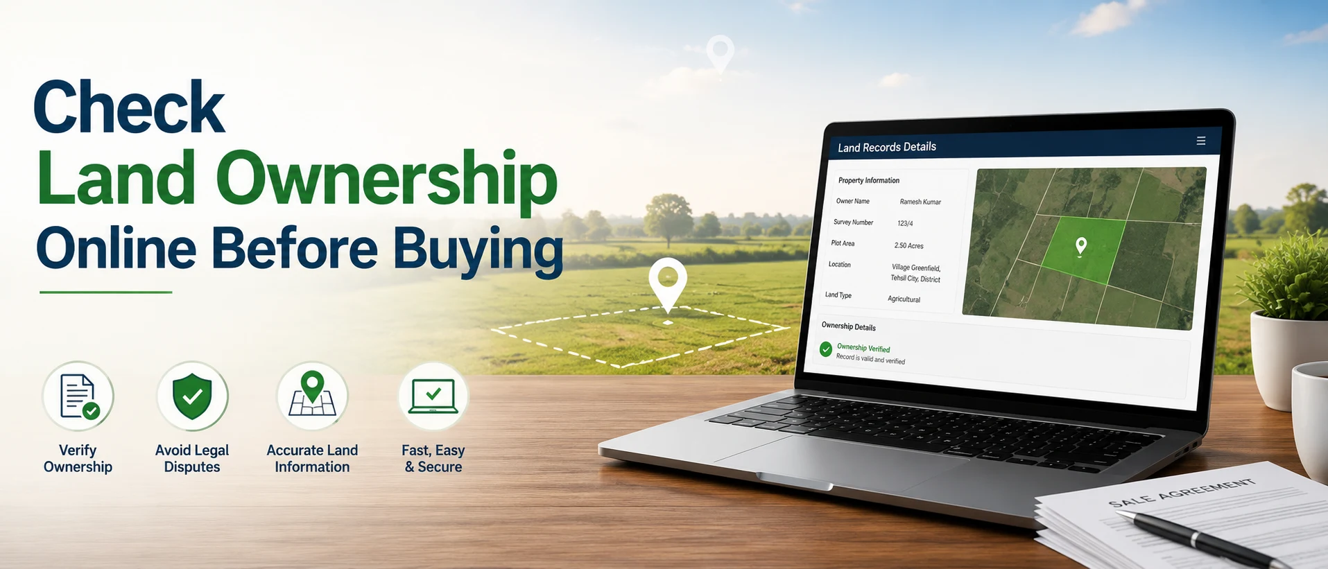
Buying land used to be a “drive there, ask locals, trust the broker” game. That still happens, especially when people buy agricultural land in India but it also explains why buyers face boundary disputes, access issues, flood-prone plots, and “looks cheap for a reason” properties.
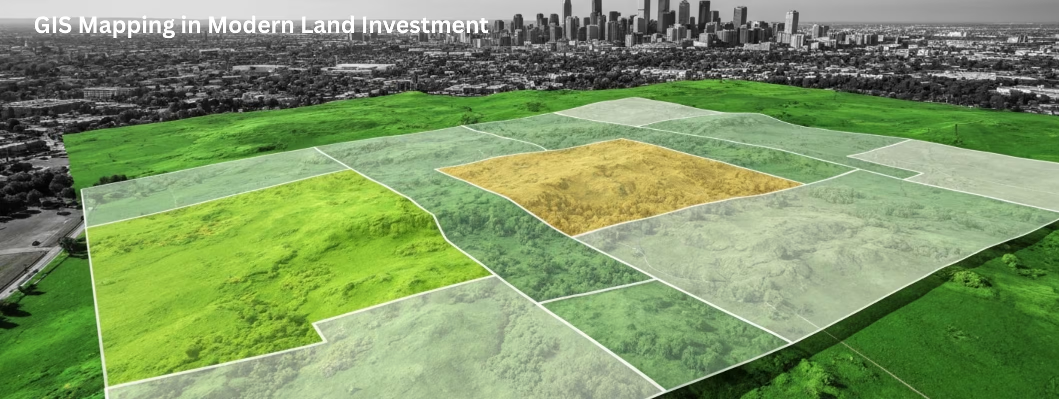
GIS mapping changes the game. It helps you see land like a planner, not like a visitor. You don’t just look at a land, you analyze it with data layers like roads, water, slope, soil, land use, nearby development, and risk zones. That is exactly why GIS has become a core tool for modern land investors.
What is GIS Mapping?
GIS (Geographic Information System) is a way to capture, store, and analyse location-based data on a map.
- Google Maps shows you where a place is.
- GIS helps you understand what that place really means for investment.
With GIS, you can overlay multiple “layers” on the same land parcel, like:
- Village/Land boundaries (cadastral maps)
- Road access and connectivity
- Water sources, canals, groundwater indicators
- Flood zones and drainage patterns
- Slope/elevation and terrain
- Soil type and land capability
- Land use (farm, forest, residential, industrial)
- Distance to markets, highways, and growth corridors
This is why GIS has become a foundation for map based land listing platforms too. Buyers want to filter land visually, compare nearby plots, and verify location logic before spending time on site visits.
Why GIS Mapping matters so much for land investment in India
Land investment is not like buying a flat. In land, a small detail can flip the deal.
1) GIS reduces location risk (the “hidden problem” factor)
A land can look perfect in photos but still be a bad investment because:
- It sits in a low-lying area that floods in monsoon
- The approach road is unofficial or disputed
- The land has steep slope, making farming or construction expensive
- Nearby land use creates restrictions (forest buffer, waterbody buffer, etc.)
GIS helps you spot these red flags early, before you pay token money.
2) GIS improves pricing judgement (not just “rate per bigha”)
In agriculture land in India, pricing depends heavily on practical factors:
- Motorable road access
- Irrigation sources and groundwater
- Soil and crop suitability
- Distance to mandi/market
- Nearby development and future connectivity
GIS lets you compare plots with the same “area” but different real-world value.
3) GIS makes due diligence faster and smarter
Good investors don’t only ask “Is the land cheap?”
They ask: “Is this land usable, accessible, scalable, and low-risk?”
GIS supports faster filtering so you spend site-visit energy only on high-quality options.
GIS vs traditional land selection: what actually changes?
Traditional method (common mistakes)
- You trust verbal claims: “road ban jayegi”, “paani toh aa jata hai”, “clear title hai”
- You judge by surface look
- You find problems only after booking
GIS-based method (modern approach)
- You verify access, terrain, water and surrounding land use first
- You shortlist scientifically
- You visit fewer plots but make better decisions
If you are investing seriously, GIS is not “extra”. It’s basic risk control.
Key GIS layers that investors should check before buying land
Here are the most useful GIS checks for land buyers in India:
1) Boundary and location accuracy (the first non-negotiable)
Many disputes start because the “shown land” and “actual land” don’t match. With GIS + cadastral mapping, you can match:
- Khasra/plot number location (where available)
- Village boundary context
- Nearby reference points (roads, canals, landmarks)
This is also why map based land listing is growing—buyers want more confidence that a listing’s pin is not random.
2) Road access and approach connectivity
A land parcel without a reliable approach is a long-term headache.
GIS can help you check:
- Distance to nearest main road/highway
- Whether the approach looks continuous and usable
- Connectivity to nearby towns/markets
Even for farming, access decides transport cost and practicality.
3) Water availability and drainage behaviour
For agricultural land in India, water decides yield, leasing value, and long-term appreciation.
GIS can support:
- Proximity to canals, ponds, rivers (where visible)
- Watershed and drainage direction (flood risk)
- Low-lying catchment areas that hold water in monsoon
This does not replace on-ground water testing—but it improves first-level screening.
4) Terrain, slope, and elevation
Flat land isn’t always perfect, but extreme slope increases cost.
GIS helps identify:
- Steep gradients
- Cut-and-fill risk (for farmhouse or plotting projects)
- Erosion-prone areas
5) Land use and surroundings (future upside or future restrictions)
Land near upcoming corridors appreciates faster, but land near restricted zones may not be easy to develop.
GIS can show:
- Existing settlement growth pattern
- Industrial zones, highways, upcoming infrastructure influence (where mapped)
- Sensitive zones (forest areas/wetlands proximity)
How GIS supports modern “map-first” land buying (step-by-step)
If you want to use GIS thinking even without being a technical person, follow this approach:
Step 1: Start with a map-based shortlist
Instead of browsing 200 listings, start with a map based land listing view and filter by:
- Budget
- Land size
- Preferred district/tehsil
- Proximity to highways/cities/landmarks
Step 2: Check the “4 basics” on the map
Before calls and visits, validate:
- Correct location (pin + surrounding match)
- Approach road visibility
- Nearest village/market distance
- Water context and low-lying risk signs
Step 3: Compare 3–5 nearby options
GIS mindset is comparative. Two plots in the same village can have very different value because of road and water.
Step 4: Do on-ground verification only after GIS shortlist
Then you visit fewer plots, ask sharper questions, and negotiate with clarity.
Common user questions about GIS mapping in land investment
“Is GIS accurate enough to trust?”
GIS is excellent for screening and comparing land. But land buying still needs on-ground verification for:
- Exact boundary marking
- Soil testing
- Water yield
- Title/ownership and encumbrance checks
Use GIS to reduce mistakes early, not to skip legal and physical due diligence.
“Does GIS help for farmland investment?”
Yes, especially for agriculture land in India. It helps you judge irrigation context, access, terrain suitability, and nearby land use patterns that impact farming income and resale.
“Can GIS help detect disputes?”
It can highlight mismatch risks (like odd plot positioning or access issues), but it can’t confirm legal disputes by itself. Legal checks need land records, encumbrance certificate, and document verification.
Practical checklist: What to verify along with GIS (don’t skip this)
Even with GIS, do these before final payment:
- Title chain / ownership proof
- Encumbrance / loan / dispute status (as applicable)
- Mutation and revenue record status (state-specific)
- Boundary demarcation on ground
- Approach road rights (not just “visible path”)
- Land use category and local rules (agri/residential conversion norms vary)
How 2Bigha.ai helps you in land investment
If you’re serious about buying land, the biggest pain is not “finding land”. It’s finding land you can trust.
1) Faster discovery with map-first search
When you use a map based land listing approach, you shortlist smarter. You don’t just scroll listings, you understand where the land sits and what surrounds it. That reduces wasted site visits and reduces “location mismatch” surprises.
2) Better clarity for agriculture land decisions
For agricultural land in India, small factors like approach, nearby water, and local access change everything. A map-driven view helps you compare lands in the same belt and pick what’s more usable, not just what’s cheaper.
3) Support for verification mindset
A good platform pushes buyers to think in terms of verification, location clarity, documents, and realistic land use, so you don’t buy based on only photos and promises.
4) Smoother shortlisting to site visit pipeline
The real value is speed + confidence: shortlist on the map, call with clarity, visit fewer plots, and negotiate from a stronger position.